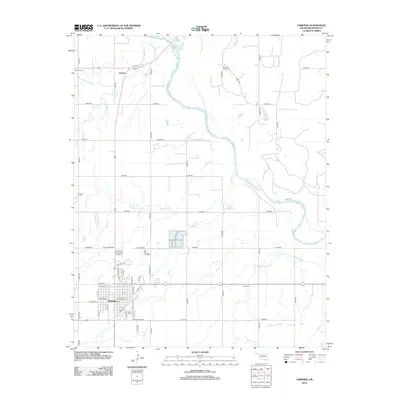
2012 Map of Fairview
USGS Topo · Published 2012About this map
Fairview anchors this central Major County landscape, where the town grid meets a network of local roads and watercourses. The Cimarron River winds through the northern and eastern portions of the map, fed by tributaries such as Cottonwood Cr and Elm Cr. To the north, the small settlement of Orienta sits at a crossroads near Saron Cem. The transition from rural agriculture to town life is evident in the layout of Fairview, which includes the Fairview Municipal Airport and residential developments along W Oklahoma Ave and E Broadway.
Find a feature on this map
56 named features on this map. Tap any name to fly to it.
Don’t see what you’re looking for? This feature index may not catch every label — zoom into the map to look around manually.
Map Details
Editions of this 2012 Fairview Map
This is the sole edition of this map. No revisions or reprints were ever made.
Other maps of this area

1955 · Woodward
USGS Topo · 1:250,000

1958 · Woodward
USGS Topo · 1:250,000

1969 · Fairview NE
USGS Topo · 1:24,000

1969 · Glass Mountains
USGS Topo · 1:24,000

1969 · Fairview SE
USGS Topo · 1:24,000

1969 · Fairview
USGS Topo · 1:24,000

1969 · Cleo Springs
USGS Topo · 1:24,000

1969 · Glass Mountains NE
USGS Topo · 1:24,000

1972 · Longdale
USGS Topo · 1:24,000

1972 · Homestead
USGS Topo · 1:24,000