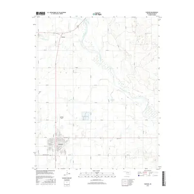
2016 Map of Fairview
USGS Topo · Published 2016About this map
Fairview serves as the primary hub in this Oklahoma landscape, its grid of streets such as W Broadway and E Central St defining the local commerce and residence. North of town, the small community of Orienta sits near the junction of several routes, while the braided channel of the Cimarron River meanders across the northeast, creating a wide alluvial plain. The map reveals a land structured by agricultural sections and drainage systems, with Cottonwood Cr and Gypsum Cr feeding into the larger river system. Local heritage is preserved in several burial grounds, including Saron Cem and Rusk Cem, while modern infrastructure is represented by the Fairview Municipal Airport and the Fairview Reservoir. The terrain is characterized by gradual elevation changes and the distinctive sand bars of the Cimarron, illustrating the persistent relationship between the prairie settlements and their water sources.
Find a feature on this map
63 named features on this map. Tap any name to fly to it.
Don’t see what you’re looking for? This feature index may not catch every label — zoom into the map to look around manually.
Map Details
Editions of this 2016 Fairview Map
This is the sole edition of this map. No revisions or reprints were ever made.
Other maps of this area

1955 · Woodward
USGS Topo · 1:250,000

1958 · Woodward
USGS Topo · 1:250,000

1969 · Fairview NE
USGS Topo · 1:24,000

1969 · Glass Mountains
USGS Topo · 1:24,000

1969 · Fairview SE
USGS Topo · 1:24,000

1969 · Fairview
USGS Topo · 1:24,000

1969 · Cleo Springs
USGS Topo · 1:24,000

1969 · Glass Mountains NE
USGS Topo · 1:24,000

1972 · Longdale
USGS Topo · 1:24,000

1972 · Homestead
USGS Topo · 1:24,000