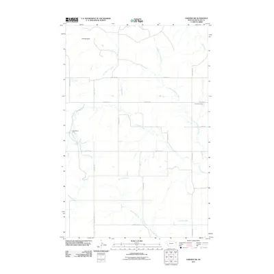
2011 Map of Fairview NW
USGS Topo · Published 2011About this map
Antelope Butte stands as a prominent landmark in this upland portion of Richland County, where the high plains are dissected by an intricate network of seasonal drainage and creek beds. The landscape is defined by the winding course of Fourmile Creek and its many tributaries, including the North Fork Fourmile Creek, which flow toward the Missouri River valley. Infrastructure in this rural corner of Montana is characterized by a precise grid of county roads, such as County Rd-143 and County Hwy-351, which provide access to remote agricultural parcels and isolated landmarks. Cultural markers like the Fourmile Cemetery and the Leo Delaney Dam suggest a history of localized water management and long-standing family ties to this semi-arid terrain. Farther south, the drainages of Second Hay Creek and Third Hay Creek underscore the importance of natural watercourses in an area dominated by cattle ranching and dry-land farming.
Find a feature on this map
20 named features on this map. Tap any name to fly to it.
Don’t see what you’re looking for? This feature index may not catch every label — zoom into the map to look around manually.
Map Details
Editions of this 2011 Fairview NW Map
This is the sole edition of this map. No revisions or reprints were ever made.
Other maps of this area

1909 · Glendive
USGS Topo · 1:250,000

1954 · Glendive
USGS Topo · 1:250,000

1954 · Wolf Point
USGS Topo · 1:250,000

1957 · Glendive
USGS Topo · 1:250,000

1958 · Wolf Point
USGS Topo · 1:250,000

1958 · Glendive
USGS Topo · 1:250,000
1968 · Dore
USGS Topo · 1:24,000

1968 · Bainville SE
USGS Topo · 1:24,000

1969 · Cedar Coulee
USGS Topo · 1:24,000

1969 · Bainville SW
USGS Topo · 1:24,000