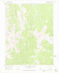
1967 Map of Fairview Peak
USGS Topo · Published 1973About this map
Gunnison National Forest dominates this mid-century topographic survey, revealing a landscape defined by high-altitude extraction and wilderness recreation. The map showcases the remnants of the area's mineral legacy with sites like the Fairview Mine, Sandy Hook Mine, and Gold Link Mine, alongside various unnamed prospects. These sites are linked by a network of historic routes including the Gunsight Trail and Union Park Trail, which traverse the steep divides of Fossil Ridge and Shaw Ridge.
Find a feature on this map
53 named features on this map. Tap any name to fly to it.
Don’t see what you’re looking for? This feature index may not catch every label — zoom into the map to look around manually.
Map Details
Editions of this 1967 Fairview Peak Map
4 editions found
Other maps of this area

1934 · Taylor Park
USGS Topo · 1:62,500

1937 · Taylor Park
USGS Topo · 1:62,500

1940 · Garfield
USGS Topo · 1:62,500

1941 · Pitkin
USGS Topo · 1:62,500

1945 · Pitkin
USGS Topo · 1:62,500

1945 · Garfield
USGS Topo · 1:62,500

1955 · Mount Harvard
USGS Topo · 1:62,500

1956 · Montrose
USGS Topo · 1:250,000

1959 · Montrose
USGS Topo · 1:250,000

1960 · Montrose
USGS Topo · 1:250,000