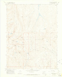
1967 Map of Fairview Peak
USGS Topo · Published 1973About this map
High-altitude mineral extraction and wilderness recreation define this portion of the Gunnison National Forest during the mid-1960s. The landscape is dominated by the massive crest of Fossil Ridge and notable summits like Henry Mountain and Fairview Peak. While much of the terrain is accessible only via primitive routes such as the Gunsight Trail and various unnamed pack trails, evidence of the area's mining history is scattered across the slopes. Documented workings include the Fairview Mine on the northern flank of Terrible Mountain and the Gold Link Mine near the southern boundary. The presence of the Gold Creek Campground and numerous alpine water bodies, including Lamphier Lake and Henry Lake, suggests a transition toward leisure and forest management as primary uses of the land in the decades following the initial mining booms.
Find a feature on this map
60 named features on this map. Tap any name to fly to it.
Don’t see what you’re looking for? This feature index may not catch every label — zoom into the map to look around manually.
Map Details
Editions of this 1967 Fairview Peak Map
4 editions found
Historical Maps of Gunnison County Through Time
375 maps found

1888 Anthracite
Gunnison County, CO

1889 Anthracite
Gunnison County, CO

1893 Anthracite
Gunnison County, CO

1894 Anthracite
Gunnison County, CO

1908 Uncompahgre
Gunnison County, CO

1911 Uncompahgre
Gunnison County, CO

1934 Taylor Park
Gunnison County, CO

1937 Taylor Park
Gunnison County, CO

1938 Mt Gunnison
Gunnison County, CO

1945 Mt. Gunnison
Gunnison County, CO

1954 Big Mesa
Gunnison County, CO

1954 Carpenter Ridge
Gunnison County, CO

1954 Gateview
Gunnison County, CO

1954 Iris Nw
Gunnison County, CO

1954 Little Soap Park
Gunnison County, CO

1954 Mc Intosh Mountain
Gunnison County, CO

1954 Sapinero
Gunnison County, CO

1954 West Elk Peak SW
Gunnison County, CO

1956 Curecanti Needle
Gunnison County, CO

1957 X Lazy F Ranch
Gunnison County, CO

1960 Snowmass Mtn
Gunnison County, CO

1961 Anthracite Range
Gunnison County, CO

1961 Cement Mountain
Gunnison County, CO

1961 Gothic
Gunnison County, CO

1961 Marcellina Mountain
Gunnison County, CO

1961 Mount Axtell
Gunnison County, CO

1961 Oh-Be-Joyful
Gunnison County, CO

1961 Pearl Pass
Gunnison County, CO

1962 Doyleville
Gunnison County, CO

1962 Houston Gulch
Gunnison County, CO

1962 Iris
Gunnison County, CO

1962 Powderhorn
Gunnison County, CO

1962 Rudolph Hill
Gunnison County, CO

1963 Alpine Plateau
Gunnison County, CO

1963 Bull Mountain
Gunnison County, CO

1963 Chair Mountain
Gunnison County, CO

1963 Courthouse Mountain
Gunnison County, CO

1963 Elk Knob
Gunnison County, CO

1963 Lost Lake
Gunnison County, CO

1963 Poison Draw
Gunnison County, CO

1963 Powderhorn Lakes
Gunnison County, CO

1963 Sheep Mountain
Gunnison County, CO

1964 Almont
Gunnison County, CO

1964 Flat Top
Gunnison County, CO

1964 Minnesota Pass
Gunnison County, CO

1964 Paonia Reservoir
Gunnison County, CO

1964 Parlin
Gunnison County, CO

1964 Sargents
Gunnison County, CO

1964 Signal Peak
Gunnison County, CO

1964 West Beckwith Peak
Gunnison County, CO

1965 Big Soap Park
Gunnison County, CO

1965 Mount Guero
Gunnison County, CO

1965 Squirrel Creek
Gunnison County, CO

1965 West Elk Peak
Gunnison County, CO

1967 Crystal Creek
Gunnison County, CO

1967 Fairview Peak
Gunnison County, CO

1967 Italian Creek
Gunnison County, CO

1967 Matchless Mountain
Gunnison County, CO

1967 Pahlone Peak
Gunnison County, CO

1967 Pieplant
Gunnison County, CO

1967 Taylor Park Reservoir
Gunnison County, CO

1982 Cumberland Pass
Gunnison County, CO

1982 Tincup
Gunnison County, CO

1982 Whitepine
Gunnison County, CO

1983 Courthouse Mountain
Gunnison County, CO

1994 Cumberland Pass
Gunnison County, CO

1994 Pahlone Peak
Gunnison County, CO

1994 Pieplant
Gunnison County, CO

1994 Tincup
Gunnison County, CO

2001 Almont
Gunnison County, CO

2001 Anthracite Range
Gunnison County, CO

2001 Big Soap Park
Gunnison County, CO

2001 Bull Mountain
Gunnison County, CO

2001 Cement Mountain
Gunnison County, CO

2001 Chair Mountain
Gunnison County, CO

2001 Crystal Creek
Gunnison County, CO

2001 Curecanti Needle
Gunnison County, CO

2001 Doyleville
Gunnison County, CO

2001 Elk Knob
Gunnison County, CO

2001 Fairview Peak
Gunnison County, CO

2001 Flat Top
Gunnison County, CO

2001 Gothic
Gunnison County, CO

2001 Houston Gulch
Gunnison County, CO

2001 Italian Creek
Gunnison County, CO

2001 Little Soap Park
Gunnison County, CO

2001 Marcellina Mountain
Gunnison County, CO

2001 Matchless Mountain
Gunnison County, CO

2001 Mc Intosh Mountain
Gunnison County, CO

2001 Minnesota Pass
Gunnison County, CO

2001 Mount Axtell
Gunnison County, CO

2001 Mount Guero
Gunnison County, CO

2001 Oh-Be-Joyful
Gunnison County, CO

2001 Paonia Reservoir
Gunnison County, CO

2001 Parlin
Gunnison County, CO

2001 Pearl Pass
Gunnison County, CO

2001 Sapinero
Gunnison County, CO

2001 Sargents
Gunnison County, CO

2001 Signal Peak
Gunnison County, CO

2001 Squirrel Creek
Gunnison County, CO

2001 Taylor Park Reservoir
Gunnison County, CO

2001 West Beckwith Mountain
Gunnison County, CO

2001 West Elk Peak
Gunnison County, CO

2001 West Elk Peak SW
Gunnison County, CO

2001 Whitepine
Gunnison County, CO

2001 X Lazy F Ranch
Gunnison County, CO

2010 Big Mesa
Gunnison County, CO

2010 Carpenter Ridge
Gunnison County, CO

2010 Gateview
Gunnison County, CO

2010 Iris
Gunnison County, CO

2010 Iris NW
Gunnison County, CO

2010 Powderhorn
Gunnison County, CO

2010 Powderhorn Lakes
Gunnison County, CO

2011 Almont
Gunnison County, CO

2011 Alpine Plateau
Gunnison County, CO

2011 Anthracite Range
Gunnison County, CO

2011 Big Soap Park
Gunnison County, CO

2011 Bull Mountain
Gunnison County, CO

2011 Cement Mountain
Gunnison County, CO

2011 Chair Mountain
Gunnison County, CO

2011 Courthouse Mountain
Gunnison County, CO

2011 Crystal Creek
Gunnison County, CO

2011 Cumberland Pass
Gunnison County, CO

2011 Curecanti Needle
Gunnison County, CO

2011 Doyleville
Gunnison County, CO

2011 Elk Knob
Gunnison County, CO

2011 Fairview Peak
Gunnison County, CO

2011 Flat Top
Gunnison County, CO

2011 Gothic
Gunnison County, CO

2011 Houston Gulch
Gunnison County, CO

2011 Italian Creek
Gunnison County, CO

2011 Little Soap Park
Gunnison County, CO

2011 Lost Lake
Gunnison County, CO

2011 Marcellina Mountain
Gunnison County, CO

2011 Matchless Mountain
Gunnison County, CO

2011 McIntosh Mountain
Gunnison County, CO

2011 Minnesota Pass
Gunnison County, CO

2011 Mount Axtell
Gunnison County, CO

2011 Mount Guero
Gunnison County, CO

2011 Oh-be-joyful
Gunnison County, CO

2011 Pahlone Peak
Gunnison County, CO

2011 Paonia Reservoir
Gunnison County, CO

2011 Parlin
Gunnison County, CO

2011 Pearl Pass
Gunnison County, CO

2011 Pieplant
Gunnison County, CO

2011 Poison Draw
Gunnison County, CO

2011 Rudolph Hill
Gunnison County, CO

2011 Sapinero
Gunnison County, CO

2011 Sargents
Gunnison County, CO

2011 Sheep Mountain
Gunnison County, CO

2011 Signal Peak
Gunnison County, CO

2011 Snowmass Mountain
Gunnison County, CO

2011 Squirrel Creek
Gunnison County, CO

2011 Taylor Park Reservoir
Gunnison County, CO

2011 Tincup
Gunnison County, CO

2011 West Beckwith Mountain
Gunnison County, CO

2011 West Elk Peak
Gunnison County, CO

2011 West Elk Peak SW
Gunnison County, CO

2011 Whitepine
Gunnison County, CO

2011 X Lazy F Ranch
Gunnison County, CO

2013 Almont
Gunnison County, CO

2013 Alpine Plateau
Gunnison County, CO

2013 Anthracite Range
Gunnison County, CO

2013 Big Mesa
Gunnison County, CO

2013 Big Soap Park
Gunnison County, CO

2013 Bull Mountain
Gunnison County, CO

2013 Carpenter Ridge
Gunnison County, CO

2013 Cement Mountain
Gunnison County, CO

2013 Chair Mountain
Gunnison County, CO

2013 Courthouse Mountain
Gunnison County, CO

2013 Crystal Creek
Gunnison County, CO

2013 Cumberland Pass
Gunnison County, CO

2013 Curecanti Needle
Gunnison County, CO

2013 Doyleville
Gunnison County, CO

2013 Elk Knob
Gunnison County, CO

2013 Fairview Peak
Gunnison County, CO

2013 Flat Top
Gunnison County, CO

2013 Gateview
Gunnison County, CO

2013 Gothic
Gunnison County, CO

2013 Houston Gulch
Gunnison County, CO

2013 Iris
Gunnison County, CO

2013 Iris NW
Gunnison County, CO

2013 Italian Creek
Gunnison County, CO

2013 Little Soap Park
Gunnison County, CO

2013 Lost Lake
Gunnison County, CO

2013 Marcellina Mountain
Gunnison County, CO

2013 Matchless Mountain
Gunnison County, CO

2013 McIntosh Mountain
Gunnison County, CO

2013 Minnesota Pass
Gunnison County, CO

2013 Mount Axtell
Gunnison County, CO

2013 Mount Guero
Gunnison County, CO

2013 Oh-be-joyful
Gunnison County, CO

2013 Pahlone Peak
Gunnison County, CO

2013 Paonia Reservoir
Gunnison County, CO

2013 Parlin
Gunnison County, CO

2013 Pearl Pass
Gunnison County, CO

2013 Pieplant
Gunnison County, CO

2013 Poison Draw
Gunnison County, CO

2013 Powderhorn
Gunnison County, CO

2013 Powderhorn Lakes
Gunnison County, CO

2013 Rudolph Hill
Gunnison County, CO

2013 Sapinero
Gunnison County, CO

2013 Sargents
Gunnison County, CO

2013 Sheep Mountain
Gunnison County, CO

2013 Signal Peak
Gunnison County, CO

2013 Snowmass Mountain
Gunnison County, CO

2013 Squirrel Creek
Gunnison County, CO

2013 Taylor Park Reservoir
Gunnison County, CO

2013 Tincup
Gunnison County, CO

2013 West Beckwith Mountain
Gunnison County, CO

2013 West Elk Peak
Gunnison County, CO

2013 West Elk Peak SW
Gunnison County, CO

2013 Whitepine
Gunnison County, CO

2013 X Lazy F Ranch
Gunnison County, CO

2016 Almont
Gunnison County, CO

2016 Alpine Plateau
Gunnison County, CO

2016 Anthracite Range
Gunnison County, CO

2016 Big Mesa
Gunnison County, CO

2016 Big Soap Park
Gunnison County, CO

2016 Bull Mountain
Gunnison County, CO

2016 Carpenter Ridge
Gunnison County, CO

2016 Cement Mountain
Gunnison County, CO

2016 Chair Mountain
Gunnison County, CO

2016 Courthouse Mountain
Gunnison County, CO

2016 Crystal Creek
Gunnison County, CO

2016 Cumberland Pass
Gunnison County, CO

2016 Curecanti Needle
Gunnison County, CO

2016 Doyleville
Gunnison County, CO

2016 Elk Knob
Gunnison County, CO

2016 Fairview Peak
Gunnison County, CO

2016 Flat Top
Gunnison County, CO

2016 Gateview
Gunnison County, CO

2016 Gothic
Gunnison County, CO

2016 Houston Gulch
Gunnison County, CO

2016 Iris
Gunnison County, CO

2016 Iris NW
Gunnison County, CO

2016 Italian Creek
Gunnison County, CO

2016 Little Soap Park
Gunnison County, CO

2016 Lost Lake
Gunnison County, CO

2016 Marcellina Mountain
Gunnison County, CO

2016 Matchless Mountain
Gunnison County, CO

2016 McIntosh Mountain
Gunnison County, CO

2016 Minnesota Pass
Gunnison County, CO

2016 Mount Axtell
Gunnison County, CO

2016 Mount Guero
Gunnison County, CO

2016 Oh-be-joyful
Gunnison County, CO

2016 Pahlone Peak
Gunnison County, CO

2016 Paonia Reservoir
Gunnison County, CO

2016 Parlin
Gunnison County, CO

2016 Pearl Pass
Gunnison County, CO

2016 Pieplant
Gunnison County, CO

2016 Poison Draw
Gunnison County, CO

2016 Powderhorn
Gunnison County, CO

2016 Powderhorn Lakes
Gunnison County, CO

2016 Rudolph Hill
Gunnison County, CO

2016 Sapinero
Gunnison County, CO

2016 Sargents
Gunnison County, CO

2016 Sheep Mountain
Gunnison County, CO

2016 Signal Peak
Gunnison County, CO

2016 Snowmass Mountain
Gunnison County, CO

2016 Squirrel Creek
Gunnison County, CO

2016 Taylor Park Reservoir
Gunnison County, CO

2016 Tincup
Gunnison County, CO

2016 West Beckwith Mountain
Gunnison County, CO

2016 West Elk Peak
Gunnison County, CO

2016 West Elk Peak SW
Gunnison County, CO

2016 Whitepine
Gunnison County, CO

2016 X Lazy F Ranch
Gunnison County, CO

2019 Almont
Gunnison County, CO

2019 Alpine Plateau
Gunnison County, CO

2019 Anthracite Range
Gunnison County, CO

2019 Big Mesa
Gunnison County, CO

2019 Big Soap Park
Gunnison County, CO

2019 Bull Mountain
Gunnison County, CO

2019 Carpenter Ridge
Gunnison County, CO

2019 Cement Mountain
Gunnison County, CO

2019 Chair Mountain
Gunnison County, CO

2019 Courthouse Mountain
Gunnison County, CO

2019 Crystal Creek
Gunnison County, CO

2019 Cumberland Pass
Gunnison County, CO

2019 Curecanti Needle
Gunnison County, CO

2019 Doyleville
Gunnison County, CO

2019 Elk Knob
Gunnison County, CO

2019 Fairview Peak
Gunnison County, CO

2019 Flat Top
Gunnison County, CO

2019 Gateview
Gunnison County, CO

2019 Gothic
Gunnison County, CO

2019 Houston Gulch
Gunnison County, CO

2019 Iris
Gunnison County, CO

2019 Iris NW
Gunnison County, CO

2019 Italian Creek
Gunnison County, CO

2019 Little Soap Park
Gunnison County, CO

2019 Lost Lake
Gunnison County, CO

2019 Marcellina Mountain
Gunnison County, CO

2019 Matchless Mountain
Gunnison County, CO

2019 McIntosh Mountain
Gunnison County, CO

2019 Minnesota Pass
Gunnison County, CO

2019 Mount Axtell
Gunnison County, CO

2019 Mount Guero
Gunnison County, CO

2019 Oh-be-joyful
Gunnison County, CO

2019 Pahlone Peak
Gunnison County, CO

2019 Paonia Reservoir
Gunnison County, CO

2019 Parlin
Gunnison County, CO

2019 Pearl Pass
Gunnison County, CO

2019 Pieplant
Gunnison County, CO

2019 Poison Draw
Gunnison County, CO

2019 Powderhorn
Gunnison County, CO

2019 Powderhorn Lakes
Gunnison County, CO

2019 Rudolph Hill
Gunnison County, CO

2019 Sapinero
Gunnison County, CO

2019 Sargents
Gunnison County, CO

2019 Sheep Mountain
Gunnison County, CO

2019 Signal Peak
Gunnison County, CO

2019 Snowmass Mountain
Gunnison County, CO

2019 Squirrel Creek
Gunnison County, CO

2019 Taylor Park Reservoir
Gunnison County, CO

2019 Tincup
Gunnison County, CO

2019 West Beckwith Mountain
Gunnison County, CO

2019 West Elk Peak
Gunnison County, CO

2019 West Elk Peak SW
Gunnison County, CO

2019 Whitepine
Gunnison County, CO

2019 X Lazy F Ranch
Gunnison County, CO

2022 Almont
Gunnison County, CO

2022 Alpine Plateau
Gunnison County, CO

2022 Anthracite Range
Gunnison County, CO

2022 Big Mesa
Gunnison County, CO

2022 Big Soap Park
Gunnison County, CO

2022 Bull Mountain
Gunnison County, CO

2022 Carpenter Ridge
Gunnison County, CO

2022 Cement Mountain
Gunnison County, CO

2022 Chair Mountain
Gunnison County, CO

2022 Courthouse Mountain
Gunnison County, CO

2022 Crystal Creek
Gunnison County, CO

2022 Cumberland Pass
Gunnison County, CO

2022 Curecanti Needle
Gunnison County, CO

2022 Doyleville
Gunnison County, CO

2022 Elk Knob
Gunnison County, CO

2022 Fairview Peak
Gunnison County, CO

2022 Flat Top
Gunnison County, CO

2022 Gateview
Gunnison County, CO

2022 Gothic
Gunnison County, CO

2022 Houston Gulch
Gunnison County, CO

2022 Iris
Gunnison County, CO

2022 Iris NW
Gunnison County, CO

2022 Italian Creek
Gunnison County, CO

2022 Little Soap Park
Gunnison County, CO

2022 Lost Lake
Gunnison County, CO

2022 Marcellina Mountain
Gunnison County, CO

2022 Matchless Mountain
Gunnison County, CO

2022 McIntosh Mountain
Gunnison County, CO

2022 Minnesota Pass
Gunnison County, CO

2022 Mount Axtell
Gunnison County, CO

2022 Mount Guero
Gunnison County, CO

2022 Oh-be-joyful
Gunnison County, CO

2022 Pahlone Peak
Gunnison County, CO

2022 Paonia Reservoir
Gunnison County, CO

2022 Parlin
Gunnison County, CO

2022 Pearl Pass
Gunnison County, CO

2022 Pieplant
Gunnison County, CO

2022 Poison Draw
Gunnison County, CO

2022 Powderhorn
Gunnison County, CO

2022 Powderhorn Lakes
Gunnison County, CO

2022 Rudolph Hill
Gunnison County, CO

2022 Sapinero
Gunnison County, CO

2022 Sargents
Gunnison County, CO

2022 Sheep Mountain
Gunnison County, CO

2022 Signal Peak
Gunnison County, CO

2022 Snowmass Mountain
Gunnison County, CO

2022 Squirrel Creek
Gunnison County, CO

2022 Taylor Park Reservoir
Gunnison County, CO

2022 Tincup
Gunnison County, CO

2022 West Beckwith Mountain
Gunnison County, CO

2022 West Elk Peak
Gunnison County, CO

2022 West Elk Peak SW
Gunnison County, CO

2022 Whitepine
Gunnison County, CO

2022 X Lazy F Ranch
Gunnison County, CO