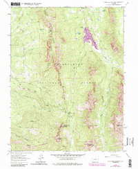
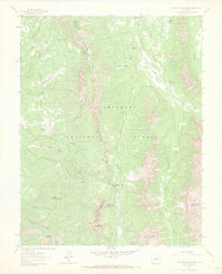
1963 Map of Courthouse Mountain
USGS Topo · Published 1984About this map
Courthouse Mountain and Dunsinane Mountain dominate this corner of the Colorado high country where the jagged spine of Cimarron Ridge serves as a natural boundary between Gunnison, Ouray, and Hinsdale counties. The landscape in the early 1960s, shown with 1980s updates, reflects a wilderness managed for both resource protection and water storage, most notably at the Silver Jack Reservoir along the Cimarron River. Human footprints are sparse but significant, ranging from the high-altitude Kennedy Mine on North Fork to the Jackson Guard Station and the curiously named Cabbage Patch settlement. The map provides clear evidence of mid-century infrastructure in the backcountry, including the Cimarron Feeder Ditch and primitive routes over Owl Creek Pass, showing how early ranching and mining access evolved into the recreation-focused Uncompahgre National Forest.
Find a feature on this map
40 named features on this map. Tap any name to fly to it.
Don’t see what you’re looking for? This feature index may not catch every label — zoom into the map to look around manually.
Map Details
Editions of this 1963 Courthouse Mountain Map
5 editions found
Other maps of this area

1902 · Ouray
USGS Topo · 1:62,500

1903 · Lake City
USGS Topo · 1:62,500

1904 · Ouray
USGS Topo · 1:62,500

1905 · Lake City
USGS Topo · 1:62,500

1908 · Uncompahgre
USGS Topo · 1:125,000

1909 · Montrose
USGS Topo · 1:125,000

1911 · Uncompahgre
USGS Topo · 1:125,000

1911 · Montrose
USGS Topo · 1:125,000

1955 · Ouray
USGS Topo · 1:24,000

1956 · Montrose
USGS Topo · 1:250,000