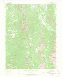
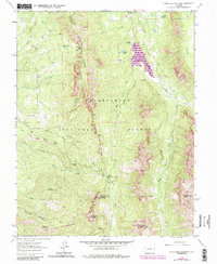
1963 Map of Courthouse Mountain
USGS Topo · Published 1966About this map
Cimarron Ridge serves as a prominent natural divider in the heart of the Uncompahgre National Forest, where the boundaries of Ouray, Gunnison, and Hinsdale counties meet. This 1963 survey documents a remote high-altitude landscape defined by steep drainages like Devils Canyon and the headwaters of the Cimarron River. The Presence of the Kennedy Mine and an unnamed Mine near Fox Creek indicates the legacy of prospectors working these mountain slopes, while the Jackson Guard Station marks the administrative footprint of the forest service in the early 1960s.
Find a feature on this map
38 named features on this map. Tap any name to fly to it.
Don’t see what you’re looking for? This feature index may not catch every label — zoom into the map to look around manually.
Map Details
Editions of this 1963 Courthouse Mountain Map
5 editions found
Other maps of this area

1902 · Ouray
USGS Topo · 1:62,500

1903 · Lake City
USGS Topo · 1:62,500

1904 · Ouray
USGS Topo · 1:62,500

1905 · Lake City
USGS Topo · 1:62,500

1908 · Uncompahgre
USGS Topo · 1:125,000

1909 · Montrose
USGS Topo · 1:125,000

1911 · Uncompahgre
USGS Topo · 1:125,000

1911 · Montrose
USGS Topo · 1:125,000

1955 · Ouray
USGS Topo · 1:24,000

1956 · Montrose
USGS Topo · 1:250,000