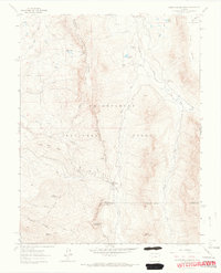
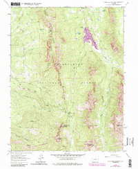
1963 Map of Courthouse Mountain
USGS Topo · Published 1966About this map
The Uncompahgre National Forest dominates this landscape, where the Cimarron River and its multiple forks carve through the high elevations of the San Juan Mountains. The 1963 survey captures a territory defined by complex topography and traditional land use, including the Kennedy Mine and the Jackson Guard Station. Significant geological landmarks like Chimney Rock and Courthouse Mountain provide anchor points for navigation along the Alpine Trail and various unnamed paths that navigate the Cimarron Ridge. The map also traces the county lines of Gunnison, Ouray, and Hinsdale, illustrating how these political boundaries intersect with natural features like Sneva Mountain and the high plateau of High Mesa.
Find a feature on this map
33 named features on this map. Tap any name to fly to it.
Don’t see what you’re looking for? This feature index may not catch every label — zoom into the map to look around manually.
Map Details
Editions of this 1963 Courthouse Mountain Map
5 editions found
Other maps of this area

1902 · Ouray
USGS Topo · 1:62,500

1903 · Lake City
USGS Topo · 1:62,500

1904 · Ouray
USGS Topo · 1:62,500

1905 · Lake City
USGS Topo · 1:62,500

1908 · Uncompahgre
USGS Topo · 1:125,000

1909 · Montrose
USGS Topo · 1:125,000

1911 · Uncompahgre
USGS Topo · 1:125,000

1911 · Montrose
USGS Topo · 1:125,000

1955 · Ouray
USGS Topo · 1:24,000

1956 · Montrose
USGS Topo · 1:250,000