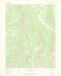
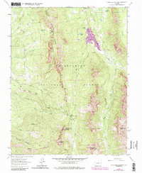
1963 Map of Courthouse Mountain
USGS Topo · Published 1970About this map
Courthouse Mountain and the jagged Cimarron Ridge dominate this high-altitude landscape within the Uncompahgre National Forest. During the early 1960s, this area remained largely inaccessible except by a network of primitive routes, including the Jeep Trail and various pack trails used for forest management and mining access. The map reveals evidence of early resource extraction at the Kennedy Mine and a simple mine near Deer Creek.
Find a feature on this map
39 named features on this map. Tap any name to fly to it.
Don’t see what you’re looking for? This feature index may not catch every label — zoom into the map to look around manually.
Map Details
Editions of this 1963 Courthouse Mountain Map
5 editions found
Other maps of this area

1902 · Ouray
USGS Topo · 1:62,500

1903 · Lake City
USGS Topo · 1:62,500

1904 · Ouray
USGS Topo · 1:62,500

1905 · Lake City
USGS Topo · 1:62,500

1908 · Uncompahgre
USGS Topo · 1:125,000

1909 · Montrose
USGS Topo · 1:125,000

1911 · Uncompahgre
USGS Topo · 1:125,000

1911 · Montrose
USGS Topo · 1:125,000

1955 · Ouray
USGS Topo · 1:24,000

1956 · Montrose
USGS Topo · 1:250,000