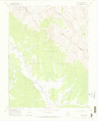
1967 Map of Pieplant
USGS Topo · Published 1972About this map
The Continental Divide zigzags across this high-altitude landscape where the headwaters of the Taylor River meet the steep slopes of Grizzly Peak and Red Mountain. This 1967 field-checked survey captures the area's transition from a mining frontier to a recreational wilderness, bordered by the Gunnison, White River, and San Isabel national forests. Evidence of former industrial activity is concentrated near Pieplant Creek, where the Pieplant Mine and Pieplant Mill (Site) sit below the timberline. The presence of the Pieplant Cow Camp and Dinner Station Campground suggests a landscape utilized for both seasonal grazing and early mountain tourism. High-country access is defined by a network of primitive routes, including the Timberline Trail and various pack trails crossing through Lake Pass and into Sayres Gulch.
Find a feature on this map
35 named features on this map. Tap any name to fly to it.
Don’t see what you’re looking for? This feature index may not catch every label — zoom into the map to look around manually.
Map Details
Editions of this 1967 Pieplant Map
3 editions found
Other maps of this area

1889 · Leadville
USGS Topo · 1:125,000

1891 · Leadville
USGS Topo · 1:125,000

1909 · Mount Jackson
USGS Topo · 1:125,000

1911 · Mount Jackson
USGS Topo · 1:125,000

1934 · Taylor Park
USGS Topo · 1:62,500

1935 · Mount Elbert
USGS Topo · 1:62,500

1937 · Taylor Park
USGS Topo · 1:62,500

1938 · Mount Elbert
USGS Topo · 1:62,500

1939 · Mount Elbert
USGS Topo · 1:62,500

1942 · Leadville
USGS Topo · 1:125,000