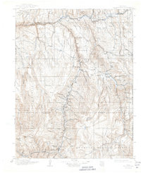
1911 Map of Uncompahgre
USGS Topo · Published 1944About this map
Lake City serves as a primary hub in this high-altitude survey, anchored by the narrow-gauge operations of the Denver and Rio Grande RR which follows the Gunnison River through the dramatic Black Canyon. The map details a landscape of transition where mining camps like Spencer, Vulcan, and Dubois dot the drainages of Cebolla Creek and Willow Creek. Industrial markers of the early twentieth century are prominent, including the Gunnison Mine and the timber operations at Van Boxels Sawmill.
Find a feature on this map
77 named features on this map. Tap any name to fly to it.
Don’t see what you’re looking for? This feature index may not catch every label — zoom into the map to look around manually.
Map Details
Editions of this 1911 Uncompahgre Map
2 editions found

Other maps of this area

1897 · Silverton
USGS Topo · 1:62,500

1901 · Silverton
USGS Topo · 1:62,500

1902 · Silverton
USGS Topo · 1:62,500

1902 · Ouray
USGS Topo · 1:62,500

1903 · Lake City
USGS Topo · 1:62,500

1904 · Ouray
USGS Topo · 1:62,500

1905 · Lake City
USGS Topo · 1:62,500

1905 · San Cristobal
USGS Topo · 1:125,000

1907 · San Cristobal
USGS Topo · 1:125,000

1908 · Uncompahgre
USGS Topo · 1:125,000