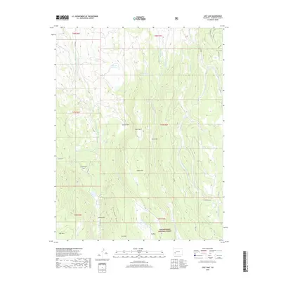
2019 Map of Lost Lake
USGS Topo · Published 2019About this map
The Uncompahgre National Forest dominates this high-altitude landscape in Montrose County, where complex water management systems define the terrain. Irrigation and water storage are central to the area's development, evidenced by features like the Big Blue Ditch, Butte Ditch, and Fitzpatrick Reservoir. These engineered waterways cut across natural drainages like the Little Cimarron River and Little Blue Cr, moving water across the mesas to support regional needs. High-country meadows and plateaus such as Duckett Park, Horse Mesa, and High Mesa are interspersed with numerous alpine lakes, including Lost Lake and Swanson Lake. The infrastructure of the area is further marked by Burro Bridge and a network of forest roads like Co RD 864, which provide access to these remote parks and draws.
Find a feature on this map
47 named features on this map. Tap any name to fly to it.
Don’t see what you’re looking for? This feature index may not catch every label — zoom into the map to look around manually.
Map Details
Editions of this 2019 Lost Lake Map
This is the sole edition of this map. No revisions or reprints were ever made.
Other maps of this area

1902 · Ouray
USGS Topo · 1:62,500

1903 · Lake City
USGS Topo · 1:62,500

1904 · Ouray
USGS Topo · 1:62,500

1905 · Lake City
USGS Topo · 1:62,500

1908 · Uncompahgre
USGS Topo · 1:125,000

1909 · Montrose
USGS Topo · 1:125,000

1911 · Uncompahgre
USGS Topo · 1:125,000

1911 · Montrose
USGS Topo · 1:125,000

1954 · Sapinero
USGS Topo · 1:24,000

1956 · Curecanti Needle
USGS Topo · 1:24,000