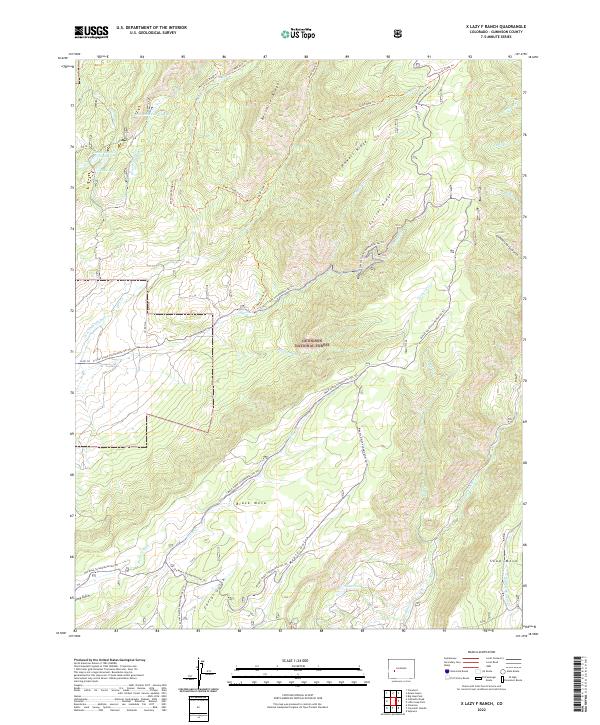
2022 Map of X Lazy F Ranch
USGS Topo · Published 2022About this map
Gunnison National Forest dominates this high-altitude landscape in Gunnison County, where the terrain is defined by a series of prominent northwest-to-southeast trending features like Mendicant Ridge, Bellmire Ridge, and Powell Ridge. This environment is shaped by an intricate drainage system including Dyer Creek and Crystal Creek, which flow through deep gulches towards the broader plateau of Black Mesa. The presence of the Grand View Ditch, Dyer Fork Ditch, and Mesa Creek Ditch alongside Castle Reservoir Number 1 and Castle Reservoir Number 3 indicates a managed water system designed to support ranching and resource use in this arid high-elevation environment. Numerous trails, such as the Mesa Creek Snowmobile/Ski Trail and Meyers Gulch Snowmobile/Ski Trail, crisscross the area, suggesting a land utilized for both traditional ranching operations and seasonal recreation.
Find a feature on this map
47 named features on this map. Tap any name to fly to it.
Don’t see what you’re looking for? This feature index may not catch every label — zoom into the map to look around manually.
Map Details
Editions of this 2022 X Lazy F Ranch Map
This is the sole edition of this map. No revisions or reprints were ever made.
Other maps of this area

1908 · Uncompahgre
USGS Topo · 1:125,000

1909 · Montrose
USGS Topo · 1:125,000

1911 · Uncompahgre
USGS Topo · 1:125,000

1911 · Montrose
USGS Topo · 1:125,000

1954 · Little Soap Park
USGS Topo · 1:24,000

1954 · Sapinero
USGS Topo · 1:24,000

1956 · Curecanti Needle
USGS Topo · 1:24,000

1956 · Cimarron
USGS Topo · 1:24,000

1956 · Montrose
USGS Topo · 1:250,000

1957 · Cathedral Peak
USGS Topo · 1:24,000