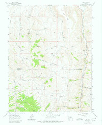
1962 Map of Iris
USGS Topo · Published 1980About this map
Iris and the surrounding mining district of the Gunnison and Saguache County line define this high-elevation landscape as it appeared in the mid-20th century. The settlement at Iris is marked by the presence of the Denver City Mine and Mineral Hill Mine, reflecting a historical reliance on mineral extraction in the region. To the north, homesteading is evident through family-named sites like the Flick Homestead and Mick Homestead, while the eastern portion of the map transitions toward ranching interests such as the Kreuger Ranch near Sillsville.
Find a feature on this map
54 named features on this map. Tap any name to fly to it.
Don’t see what you’re looking for? This feature index may not catch every label — zoom into the map to look around manually.
Map Details
Editions of this 1962 Iris Map
4 editions found
Other maps of this area

1941 · Pitkin
USGS Topo · 1:62,500

1945 · Pitkin
USGS Topo · 1:62,500

1954 · Iris NW
USGS Topo · 1:24,000

1954 · Gunnison
USGS Topo · 1:24,000

1956 · Montrose
USGS Topo · 1:250,000

1959 · Montrose
USGS Topo · 1:250,000

1960 · Montrose
USGS Topo · 1:250,000

1962 · Iris
USGS Topo · 1:24,000

1962 · Houston Gulch
USGS Topo · 1:24,000

1962 · Razor Creek Dome
USGS Topo · 1:24,000