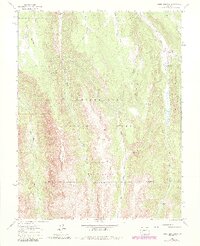
1963 Map of Sheep Mountain
USGS Topo · Published 1984About this map
Uncompahgre National Forest dominates this section of the western San Juan mountains, split by the winding drainage of the Little Cimarron River. The landscape is defined by the high, flat-topped High Mesa and the prominent peak of Sheep Mountain, which straddles the county line between Gunnison and Hinsdale counties. A network of primitive routes, including the Van Boxel Trail and the Alpine Trail, connects historic seasonal clearings like Johnson Park.
Find a feature on this map
22 named features on this map. Tap any name to fly to it.
Don’t see what you’re looking for? This feature index may not catch every label — zoom into the map to look around manually.
Map Details
Editions of this 1963 Sheep Mountain Map
4 editions found
Other maps of this area

1902 · Ouray
USGS Topo · 1:62,500

1903 · Lake City
USGS Topo · 1:62,500

1904 · Ouray
USGS Topo · 1:62,500

1905 · Lake City
USGS Topo · 1:62,500

1908 · Uncompahgre
USGS Topo · 1:125,000

1909 · Montrose
USGS Topo · 1:125,000

1911 · Uncompahgre
USGS Topo · 1:125,000

1911 · Montrose
USGS Topo · 1:125,000

1956 · Montrose
USGS Topo · 1:250,000

1959 · Montrose
USGS Topo · 1:250,000