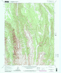
1963 Map of Sheep Mountain
USGS Topo · Published 1984About this map
Sheep Mountain dominates this high-altitude landscape where the headwaters of the Little Cimarron River and Big Blue Creek carve deep through the terrain of the Uncompahgre National Forest. The map reflects a mid-century wilderness managed for both conservation and traditional use, as seen in the presence of the Alpine Trail (Pack) and the Ridge Stock Driveway. These routes, along with the Alpine Guard Sta, suggest a period where forest management and livestock movement were primary human activities in this remote area.
Find a feature on this map
23 named features on this map. Tap any name to fly to it.
Don’t see what you’re looking for? This feature index may not catch every label — zoom into the map to look around manually.
Map Details
Editions of this 1963 Sheep Mountain Map
4 editions found
Other maps of this area

1902 · Ouray
USGS Topo · 1:62,500

1903 · Lake City
USGS Topo · 1:62,500

1904 · Ouray
USGS Topo · 1:62,500

1905 · Lake City
USGS Topo · 1:62,500

1908 · Uncompahgre
USGS Topo · 1:125,000

1909 · Montrose
USGS Topo · 1:125,000

1911 · Uncompahgre
USGS Topo · 1:125,000

1911 · Montrose
USGS Topo · 1:125,000

1956 · Montrose
USGS Topo · 1:250,000

1959 · Montrose
USGS Topo · 1:250,000