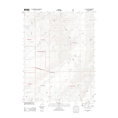
2013 Map of X Lazy F Ranch
USGS Topo · Published 2013About this map
Gunnison National Forest dominates this high-altitude landscape in Montrose and Gunnison Counties, where early 21st-century topography reveals a complex network of ranching infrastructure and water management. High plateaus like Black Mesa and Soap Mesa are dissected by drainages such as Curecanti Cr and Mesa Cr, while the presence of the X Lazy F Ranch and the Childress Cow Camp indicates the area's continued use for livestock. The map highlights the critical importance of water rights in the arid West, tracing the paths of the Grand View Ditch, Dyer Fork Ditch, and Mesa Cr Ditch which feed into numerous reservoirs including Castle Reservoir Number 1 and Castle Reservoir Number 2. A series of ridges, such as Mendicant Ridge and Bellmire Ridge, define the local relief, connected by forest service routes like the Mendicant Ridge Trl.
Find a feature on this map
46 named features on this map. Tap any name to fly to it.
Don’t see what you’re looking for? This feature index may not catch every label — zoom into the map to look around manually.
Map Details
Editions of this 2013 X Lazy F Ranch Map
This is the sole edition of this map. No revisions or reprints were ever made.
Other maps of this area

1908 · Uncompahgre
USGS Topo · 1:125,000

1909 · Montrose
USGS Topo · 1:125,000

1911 · Uncompahgre
USGS Topo · 1:125,000

1911 · Montrose
USGS Topo · 1:125,000

1954 · Little Soap Park
USGS Topo · 1:24,000

1954 · Sapinero
USGS Topo · 1:24,000

1956 · Curecanti Needle
USGS Topo · 1:24,000

1956 · Cimarron
USGS Topo · 1:24,000

1956 · Montrose
USGS Topo · 1:250,000

1957 · Cathedral Peak
USGS Topo · 1:24,000