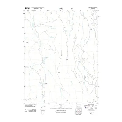
2011 Map of Lost Lake
USGS Topo · Published 2011About this map
Meaker Ranch and Miles Ranch anchor the northern landscape of this Montrose County region, where high-altitude water management is evident through the presence of the Butte Ditch, McKinley Ditch, and Fitzpatrick Reservoir. The drainage systems of the Little Cimarron River and Big Blue Creek create a network of alpine parks and mesas, including Duckett Park, Coyote Park, and Horse Mesa. Remote outposts such as Sampson Cabin, Reynolds Cabin, and Williams Cabin are connected by a sparse network of forest roads and trails like Rim Rd and County Rd 86. This map documents a high-country terrain defined by its namesake Lost Lake and the natural clearings of Grasshopper Park and Fire Park, providing an essential reference for understanding the seasonal habitation and hydraulic engineering of the Colorado high desert and mountain transition.
Find a feature on this map
46 named features on this map. Tap any name to fly to it.
Don’t see what you’re looking for? This feature index may not catch every label — zoom into the map to look around manually.
Map Details
Editions of this 2011 Lost Lake Map
This is the sole edition of this map. No revisions or reprints were ever made.
Other maps of this area

1902 · Ouray
USGS Topo · 1:62,500

1903 · Lake City
USGS Topo · 1:62,500

1904 · Ouray
USGS Topo · 1:62,500

1905 · Lake City
USGS Topo · 1:62,500

1908 · Uncompahgre
USGS Topo · 1:125,000

1909 · Montrose
USGS Topo · 1:125,000

1911 · Uncompahgre
USGS Topo · 1:125,000

1911 · Montrose
USGS Topo · 1:125,000

1954 · Sapinero
USGS Topo · 1:24,000

1956 · Curecanti Needle
USGS Topo · 1:24,000