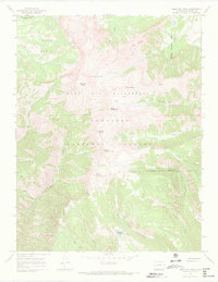
1965 Map of West Elk Peak
USGS Topo · Published 1972About this map
West Elk Peak dominates this high-altitude landscape in the Gunnison National Forest, where a network of drainage systems defines the topographic character. The area is marked by a series of prominent summits including North Baldy Mtn, Middle Baldy Mountain, and South Baldy Mountain, which separate the headwaters of numerous creeks. To the north, the sharp geologic forms of The Castles stand near Castle Creek, while the southwestern reach transitions toward Rainbow Lake.
Find a feature on this map
30 named features on this map. Tap any name to fly to it.
Don’t see what you’re looking for? This feature index may not catch every label — zoom into the map to look around manually.
Map Details
Editions of this 1965 West Elk Peak Map
3 editions found
Other maps of this area

1888 · Anthracite
USGS Topo · 1:62,500

1889 · Anthracite
USGS Topo · 1:62,500

1893 · Anthracite
USGS Topo · 1:62,500

1894 · Anthracite
USGS Topo · 1:62,500

1938 · Mt. Gunnison
USGS Topo · 1:48,000

1945 · Mount Gunnison
USGS Topo · 1:62,500

1954 · Mc Intosh Mountain
USGS Topo · 1:24,000

1954 · West Elk Peak SW
USGS Topo · 1:24,000

1954 · Little Soap Park
USGS Topo · 1:24,000

1956 · Montrose
USGS Topo · 1:250,000