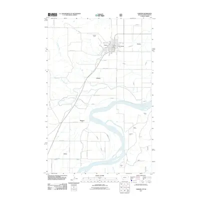
2011 Map of Fairview
USGS Topo · Published 2011About this map
The Yellowstone River cuts a wide, braided path across this borderland landscape, where the communities of Fairview and East Fairview straddle the boundary between Montana and North Dakota. This 2011 survey captures a highly organized agricultural grid defined by numerous irrigation canals, including Lateral N, Lateral M, and Lateral K, which draw from the river to support the surrounding plains.
Find a feature on this map
55 named features on this map. Tap any name to fly to it.
Don’t see what you’re looking for? This feature index may not catch every label — zoom into the map to look around manually.
Map Details
Editions of this 2011 Fairview Map
This is the sole edition of this map. No revisions or reprints were ever made.
Other maps of this area

1909 · Glendive
USGS Topo · 1:250,000

1953 · Watford City
USGS Topo · 1:250,000

1954 · Glendive
USGS Topo · 1:250,000

1957 · Glendive
USGS Topo · 1:250,000

1957 · Watford City
USGS Topo · 1:250,000

1958 · Glendive
USGS Topo · 1:250,000

1966 · Sidney NE
USGS Topo · 1:24,000

1966 · Sidney
USGS Topo · 1:24,000

1967 · Watford City
USGS Topo · 1:250,000
1968 · Buford
USGS Topo · 1:24,000