2024 Map of Fairview
USGS Topo · Published 2024About this map
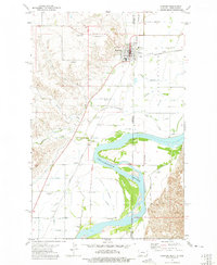
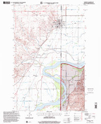
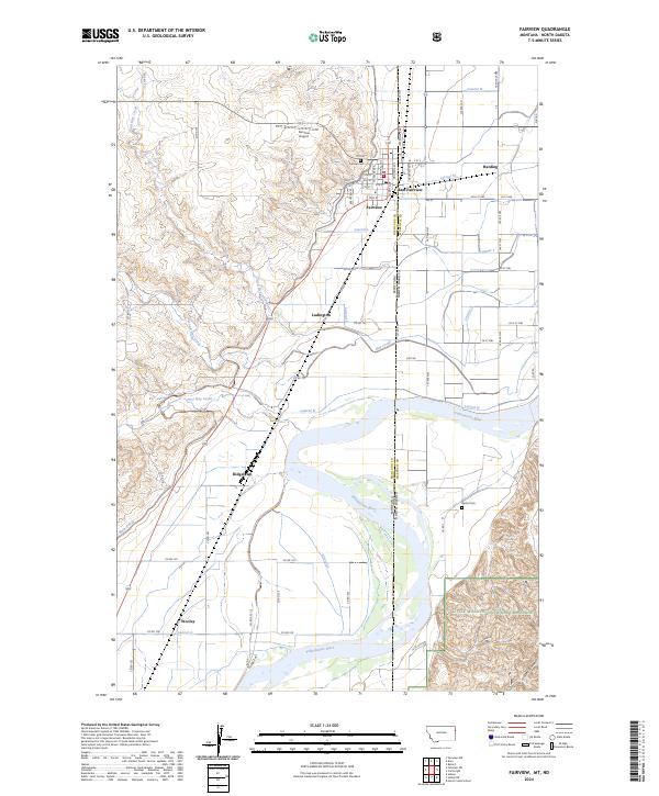
Fairview and East Fairview straddle the state line where Montana meets North Dakota, forming a cross-border community defined by its irrigation infrastructure and the Yellowstone River. This 2024 landscape is intricately carved by an extensive canal network, including the Main Canal and various laterals such as Lateral N and Lateral G, which support the agricultural economy of the river valley. To the south and east, the terrain transitions toward the Little Missouri National Grassland, where the topography shifts from level valley floors to the more broken land of Estes Coulee. Genealogy researchers will find localized landmarks like Pioneer Cem and Bethel Cem, while those tracing historical settlements can locate Ridgelawn, Wooley, and Ludington. The map also documents modern infrastructure like the Fairview Airport alongside the rural road grid of Richland Co and McKenzie Co.
Find a feature on this map
73 named features on this map. Tap any name to fly to it.
Don’t see what you’re looking for? This feature index may not catch every label — zoom into the map to look around manually.
Map Details
Editions of this 2024 Fairview Map
This is the sole edition of this map. No revisions or reprints were ever made.
Historical Maps of Ludington Through Time
3 maps found