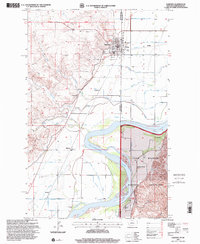
1997 Map of Fairview
USGS Topo · Published 2001About this map
The town of Fairview straddles the border between Montana and North Dakota, serving as a focal point for this agrarian landscape in the late twentieth century. To the west, the Missouri River valley is defined by the braided path of the Yellowstone River, while the eastern portion of the map transitions into the Little Missouri National Grassland. This area is marked by numerous family-named landmarks such as the M Flynn Ranch, H Pederson Ranch, and R Olson Ranch, which underscore the region's enduring ranching heritage. Local history is further preserved at the Pioneer Cem and Bethel Cem. Smaller settlements and locales like East Fairview, Ridgelawn, and Ludington are connected by a network of drainage features including the three branches of Hay Creek—First Hay Creek, Second Hay Creek, and Third Hay Creek.
Find a feature on this map
27 named features on this map. Tap any name to fly to it.
Don’t see what you’re looking for? This feature index may not catch every label — zoom into the map to look around manually.
Map Details
Editions of this 1997 Fairview Map
This is the sole edition of this map. No revisions or reprints were ever made.
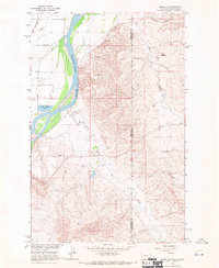
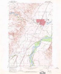
Other maps of this area

1909 · Glendive
USGS Topo · 1:250,000

1953 · Watford City
USGS Topo · 1:250,000

1954 · Glendive
USGS Topo · 1:250,000

1957 · Glendive
USGS Topo · 1:250,000

1957 · Watford City
USGS Topo · 1:250,000

1958 · Glendive
USGS Topo · 1:250,000
1966 · Sidney NE
USGS Topo · 1:24,000
1966 · Sidney
USGS Topo · 1:24,000

1967 · Watford City
USGS Topo · 1:250,000

1968 · Buford
USGS Topo · 1:24,000