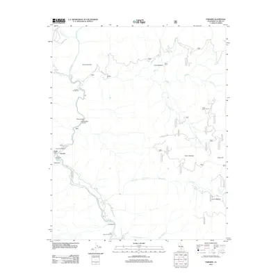
2012 Map of Fairview
USGS Topo · Published 2012About this map
The Kern River carves a deep path through this portion of the southern Sierra Nevada, serving as the primary geographic corridor for the small settlement at Fairview and the nearby Calkins Flat. At the time of this 2012 survey, the river is the focal point for a network of recreation sites, including the Fairview Campground and Lower Campground. Higher elevations to the east are defined by numerous meadows and watercourses, such as Poison Meadow and the headwaters of Salmon Cr, which drops toward the river valley at Salmon Creek Falls.
Find a feature on this map
54 named features on this map. Tap any name to fly to it.
Don’t see what you’re looking for? This feature index may not catch every label — zoom into the map to look around manually.
Map Details
Editions of this 2012 Fairview Map
This is the sole edition of this map. No revisions or reprints were ever made.
Other maps of this area

1904 · Kaweah
USGS Topo · 1:125,000

1905 · Olancha
USGS Topo · 1:125,000

1905 · Fairview
USGS Topo · 1:24,000

1906 · Kernville
USGS Topo · 1:125,000

1907 · Olancha
USGS Topo · 1:125,000

1908 · Kernville
USGS Topo · 1:125,000

1909 · Kaweah
USGS Topo · 1:125,000

1918 · Fairview
USGS Topo · 1:31,680

1936 · Tobias Peak
USGS Topo · 1:125,000

1937 · Kaweah
USGS Topo · 1:125,000