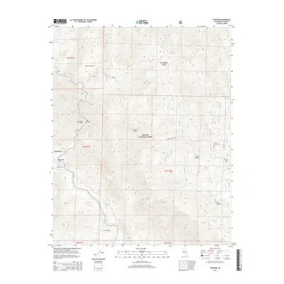
2015 Map of Fairview
USGS Topo · Published 2015About this map
The Kern River carves a deep path through the southern reaches of the Sequoia National Forest, defining the geography of this high-elevation landscape. Near the settlement of Fairview, the river is joined by numerous tributaries including South Cr and Tobias Cr, creating a complex drainage network characterized by dramatic drops such as South Creek Falls and Salmon Creek Falls. The map reveals a remote area where transportation is limited to routes like Roads End and specialized forest roads such as Rte 23514. Small pockets of level ground among the peaks, such as Calkins Flat and Brush Creek Flat, offer a rare break from the steep terrain. For those tracing the local history of Tulare County, the presence of isolated meadows like Poison Meadow, Horse Meadow, and Corral Meadow indicates the region's long-standing use for seasonal grazing and high-country exploration.
Find a feature on this map
35 named features on this map. Tap any name to fly to it.
Don’t see what you’re looking for? This feature index may not catch every label — zoom into the map to look around manually.
Map Details
Editions of this 2015 Fairview Map
This is the sole edition of this map. No revisions or reprints were ever made.
Other maps of this area

1904 · Kaweah
USGS Topo · 1:125,000

1905 · Olancha
USGS Topo · 1:125,000

1905 · Fairview
USGS Topo · 1:24,000

1906 · Kernville
USGS Topo · 1:125,000

1907 · Olancha
USGS Topo · 1:125,000

1908 · Kernville
USGS Topo · 1:125,000

1909 · Kaweah
USGS Topo · 1:125,000

1918 · Fairview
USGS Topo · 1:31,680

1936 · Tobias Peak
USGS Topo · 1:125,000

1937 · Kaweah
USGS Topo · 1:125,000