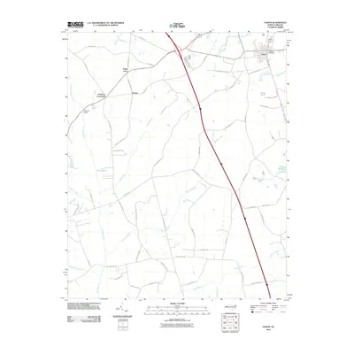
2010 Map of Faison
USGS Topo · Published 2010About this map
The town of Faison serves as the primary hub in this corner of Duplin County, featuring the Faison Post Office and a grid of streets positioned at the intersection of local routes. The surrounding landscape is defined by an extensive network of wetlands and creeks, including Six Runs Creek and the expansive Tenmile Swamp, which dictate the placement of rural settlements and transport corridors.
Find a feature on this map
62 named features on this map. Tap any name to fly to it.
Don’t see what you’re looking for? This feature index may not catch every label — zoom into the map to look around manually.
Map Details
Editions of this 2010 Faison Map
This is the sole edition of this map. No revisions or reprints were ever made.
Other maps of this area

1909 · Coharie
USGS Topo · 1:62,500

1953 · Florence
USGS Topo · 1:250,000

1953 · Raleigh
USGS Topo · 1:250,000

1954 · Florence
USGS Topo · 1:250,000

1954 · Raleigh
USGS Topo · 1:250,000

1959 · Garland
USGS Topo · 1:62,500

1962 · Rose Hill
USGS Topo · 1:62,500

1975 · Faison
USGS Topo · 1:24,000
1977 · Warsaw North
USGS Topo · 1:24,000
1977 · Mount Olive
USGS Topo · 1:24,000