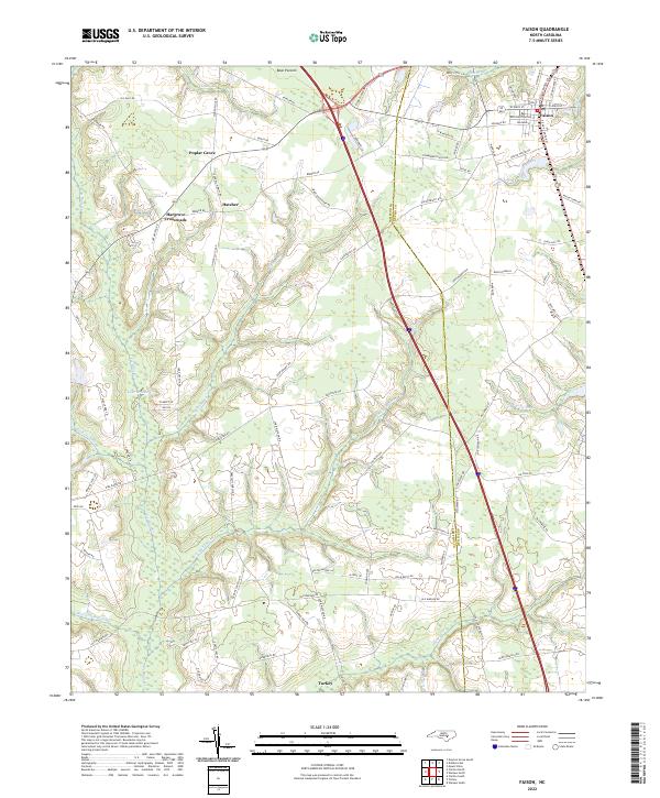
2022 Map of Faison
USGS Topo · Published 2022About this map
Faison sits at the northern edge of this coastal plain landscape, where a dense network of agricultural roads and drainage systems defines the local economy. The terrain is characterized by expansive wetlands and pocosin environments, most notably Bear Pocosin and the headwaters of numerous watercourses including Tenmile Swamp, Mill Swamp, and Bear Swamp. These features, along with Gilmore Swamp and Beaverdam Swamp, illustrate the complex hydrology that residents have navigated for generations.
Find a feature on this map
90 named features on this map. Tap any name to fly to it.
Don’t see what you’re looking for? This feature index may not catch every label — zoom into the map to look around manually.
Map Details
Editions of this 2022 Faison Map
This is the sole edition of this map. No revisions or reprints were ever made.
Other maps of this area

1909 · Coharie
USGS Topo · 1:62,500

1953 · Florence
USGS Topo · 1:250,000

1953 · Raleigh
USGS Topo · 1:250,000

1954 · Florence
USGS Topo · 1:250,000

1954 · Raleigh
USGS Topo · 1:250,000

1959 · Garland
USGS Topo · 1:62,500

1962 · Rose Hill
USGS Topo · 1:62,500

1975 · Faison
USGS Topo · 1:24,000
1977 · Warsaw North
USGS Topo · 1:24,000
1977 · Mount Olive
USGS Topo · 1:24,000