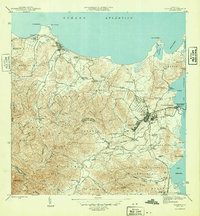
1946 Map of Fajardo
USGS Topo · Published 1946About this map
The coastal and agricultural landscape of northeastern Puerto Rico is defined here by the Fajardo and Luquillo municipal regions just after the second World War. The area is dominated by the sugar economy, evidenced by a dense network of colonias including Colonia Monserrate, Colonia Santa Rita, and Colonia San Miguel that dot the fertile valleys and hillsides. These settlements are linked by the Fajardo Development rail lines, which facilitated the transport of sugarcane to the central mills. Along the coast, the maritime importance of the region is clear, with the port at Puerto Real and Playa de Fajardo serving as vital hubs for trade and travel across the Sonda de Vieques. To the north, the protected waters of Laguna Grande and Bahia las Cabezas provide a sharp contrast to the developed industrial corridors further inland.
Find a feature on this map
80 named features on this map. Tap any name to fly to it.
Don’t see what you’re looking for? This feature index may not catch every label — zoom into the map to look around manually.
Map Details
Editions of this 1946 Fajardo Map
4 editions found
Other maps of this area

1941 · Rio Grande
USGS Topo · 1:30,000

1945 · Cayo Icacos
USGS Topo · 1:30,000

1945 · El Yunque
USGS Topo · 1:30,000

1946 · El Yunque
USGS Topo · 1:30,000

1946 · Punta Puerca
USGS Topo · 1:30,000

1946 · Naguabo
USGS Topo · 1:30,000

1946 · Fajardo
USGS Topo · 1:30,000

1947 · El Yunque NE
USGS Topo · 1:10,000

1947 · Rio Grande
USGS Topo · 1:30,000

1947 · El Yunque SE
USGS Topo · 1:10,000