1961 Map of Falcon NW
USGS Topo · Published 1970About this map
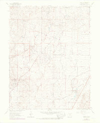
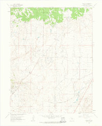
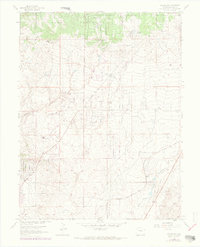
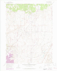
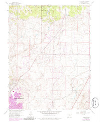
The northern reaches of the Black Forest dominate the high ground of El Paso County in this 1960s study, where timbered ridges give way to the drainage basins of Cottonwood Creek and Sand Creek. The landscape reflects a ranching and rural economy, anchored by established holdings such as the Banning Lewis Ranch, Wolf Ranch, and Hyatt Ranch. In the southern portion of the sheet, the Chicago Rock Island and Pacific Railroad cuts across the plains near the small settlement of Shirley, marking a vital transportation corridor for the region's cattle and goods.
Find a feature on this map
16 named features on this map. Tap any name to fly to it.
Don’t see what you’re looking for? This feature index may not catch every label — zoom into the map to look around manually.
Map Details
Editions of this 1961 Falcon NW Map
6 editions found

Other maps of this area

1893 · Colorado Springs
USGS Topo · 1:125,000

1894 · Castle Rock
USGS Topo · 1:125,000

1909 · Colorado Springs
USGS Topo · 1:125,000

1913 · Castle Rock
USGS Topo · 1:125,000

1940 · Elbert
USGS Topo · 1:62,500

1942 · Colorado Springs
USGS Topo · 1:125,000

1944 · Elbert
USGS Topo · 1:62,500

1948 · Falcon
USGS Topo · 1:24,000

1948 · Colorado Springs
USGS Topo · 1:62,500

1948 · Pikeview
USGS Topo · 1:24,000