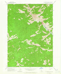
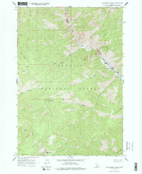
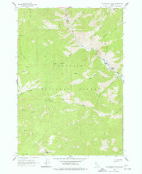
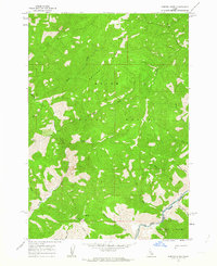
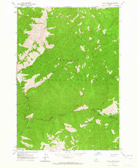
1963 Map of Falconberry Peak
USGS Topo · Published 1965About this map
The Middle Fork Salmon River carves through the northeastern corner of this 1963 survey, serving as the primary drainage for a series of high-elevation basins within the Challis National Forest. Human presence is concentrated near the river corridor, where the Falconberry Ranch and Biggs Ranch represent isolated agricultural holdings in a landscape dominated by steep peaks and deep drainages. The infrastructure of forest management is evident at the Falconberry Guard Station and the Indian Spring Guard Station, while the Falconberry Landing Strip indicates the necessity of aerial access for this backcountry area. The terrain is marked by prominent summits like Falconberry Peak and Grouse Creek Peak, with Cougar Lookout providing a strategic vantage point over the complex network of creeks, including Loon Creek and Bear Creek.
Find a feature on this map
30 named features on this map. Tap any name to fly to it.
Don’t see what you’re looking for? This feature index may not catch every label — zoom into the map to look around manually.
Map Details
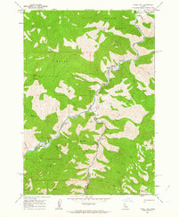
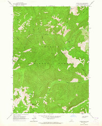
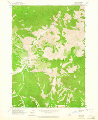
Editions of this 1963 Falconberry Peak Map
3 editions found
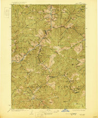
Other maps of this area
1930 · Casto
USGS Topo · 1:125,000

1957 · Challis
USGS Topo · 1:250,000

1960 · Challis
USGS Topo · 1:250,000
1962 · Norton Ridge
USGS Topo · 1:24,000
1962 · Ramey Hill
USGS Topo · 1:24,000

1963 · Challis
USGS Topo · 1:250,000
1963 · Pinyon Peak
USGS Topo · 1:24,000
1963 · Casto
USGS Topo · 1:24,000
1963 · Rock Creek
USGS Topo · 1:24,000
1963 · Sherman Peak
USGS Topo · 1:24,000