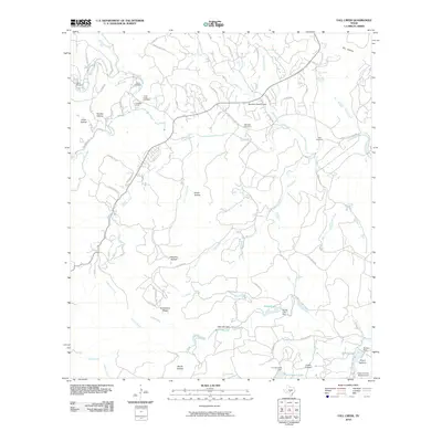
2010 Map of Fall Creek
USGS Topo · Published 2010About this map
Turtle Creek and its many tributaries, including West Creek and South Creek, define this Hill Country landscape south of Kerrville. In 2010, the area is characterized by a mix of recreational retreats and private ranching interests, with established locations like Camp Chrysalis, Camp Maddox, and Kickapoo Camp along the waterways. The local geography is etched with family-named landmarks and hollows, including Coker Hollow, Grave Hollow, and Mexican Hollow, reflecting generations of land use. Small-scale aviation is present at Barclays Roost Airport and Prison Canyon Ranch Airport, while water management is evident through a series of small impoundments such as Roden Lake, Falls Lake, and T S Clements Lake. For genealogists, the map preserves the locations of the Turtle Creek Cemetery, Habecker Cemetery, and Real Cemetery, situated near the winding network of county roads.
Find a feature on this map
74 named features on this map. Tap any name to fly to it.
Don’t see what you’re looking for? This feature index may not catch every label — zoom into the map to look around manually.
Map Details
Editions of this 2010 Fall Creek Map
This is the sole edition of this map. No revisions or reprints were ever made.
Other maps of this area

1894 · Kerrville
USGS Topo · 1:125,000

1954 · Llano
USGS Topo · 1:250,000

1954 · San Antonio
USGS Topo · 1:250,000

1955 · Llano
USGS Topo · 1:250,000

1956 · Tuff
USGS Topo · 1:62,500

1956 · Center Point
USGS Topo · 1:62,500

1956 · Llano
USGS Topo · 1:250,000

1957 · San Antonio
USGS Topo · 1:250,000

1964 · Center Point
USGS Topo · 1:24,000

1964 · Echo Hill Ranch
USGS Topo · 1:24,000