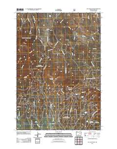
2011 Map of Fall Mountain
USGS Topo · Published 2011About this map
Fall Mountain Fire Lookout stands as a prominent sentinel over the high-elevation terrain of this Grant County quadrangle. The landscape is defined by its numerous springs, including Fall Mountain Spring, Overholt Spring, and Stark Spring, which feed a complex network of drainages like Hanscombe Creek and Ingle Creek. This 2011 survey captures the area's mix of recreational utility and traditional ranching life, seen in the proximity of the Starr Bowl Winter Sports Area to the Koehler Ranch. Significant mountain peaks such as CoalPit Mountain and Hanscombe Mountain divide the territory, while local travel is centered around County Hwy 49 and routes near Pleasant Hill. The density of named meadows and springs indicates a landscape historically valued for its water resources and seasonal activities, providing a clear record of the area's geographic features in the early 21st century.
Find a feature on this map
39 named features on this map. Tap any name to fly to it.
Don’t see what you’re looking for? This feature index may not catch every label — zoom into the map to look around manually.
Map Details
Editions of this 2011 Fall Mountain Map
This is the sole edition of this map. No revisions or reprints were ever made.
Other maps of this area

1940 · Mount Vernon
USGS Topo · 1:62,500

1940 · John Day
USGS Topo · 1:62,500

1943 · John Day
USGS Topo · 1:62,500

1943 · Mount Vernon
USGS Topo · 1:62,500

1955 · Canyon City
USGS Topo · 1:250,000

1959 · Canyon City
USGS Topo · 1:250,000

1961 · Logdell
USGS Topo · 1:62,500

1961 · Seneca
USGS Topo · 1:62,500

1972 · John Day
USGS Topo · 1:24,000

1972 · Canyon Mtn
USGS Topo · 1:24,000