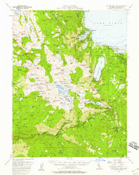
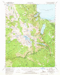
1955 Map of Fallen Leaf Lake
USGS Topo · Published 1958This historical map portrays the area of Fallen Leaf Lake in 1955, primarily covering El Dorado County as well as portions of Nevada. Featuring a scale of 1:62500, this map provides a highly detailed snapshot of the terrain, roads, buildings, counties, and historical landmarks in the Fallen Leaf Lake region at the time. Published in 1958, it is one of 7 known editions of this map due to revisions or reprints.
Find a feature on this map
205 named features on this map. Tap any name to fly to it.
Don’t see what you’re looking for? This feature index may not catch every label — zoom into the map to look around manually.
Map Details
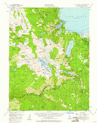
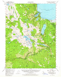
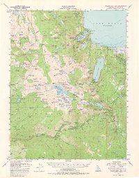
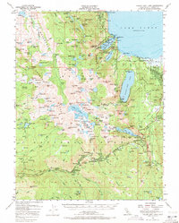
Editions of this 1955 Fallen Leaf Lake Map
7 editions found
Historical Maps of Twin Bridges Through Time
44 maps found

1889 Pyramid Peak
El Dorado County, CA

1891 Pyramid Peak
El Dorado County, CA

1895 Pyramid Peak
El Dorado County, CA

1896 Pyramid Peak
El Dorado County, CA

1949 Garden Valley
El Dorado County, CA

1949 Greenwood
El Dorado County, CA

1949 Latrobe
El Dorado County, CA

1950 Garden Valley
El Dorado County, CA

1950 Greenwood
El Dorado County, CA

1950 Latrobe
El Dorado County, CA

1950 Riverton
El Dorado County, CA

1950 Robbs Peak
El Dorado County, CA

1950 Saddle Mountain
El Dorado County, CA

1950 Slate Mtn
El Dorado County, CA

1950 Tunnel Hill
El Dorado County, CA

1951 Caldor
El Dorado County, CA

1951 Leek Spring Hill
El Dorado County, CA

1951 Leek Spring Hill
El Dorado County, CA

1951 Old Iron Mountain
El Dorado County, CA

1951 Peddler Hill
El Dorado County, CA

1952 Aukum
El Dorado County, CA

1952 Kyburz
El Dorado County, CA

1952 Loon Lake
El Dorado County, CA

1952 Omo Ranch
El Dorado County, CA

1952 Robbs Peak
El Dorado County, CA

1952 Sly Park
El Dorado County, CA

1953 Clarksville
El Dorado County, CA

1953 Sly Park
El Dorado County, CA

1954 Pilot Hill
El Dorado County, CA

1955 Echo Lake
El Dorado County, CA

1955 Emerald Bay
El Dorado County, CA

1955 Fallen Leaf Lake
El Dorado County, CA

1955 Freel Peak
El Dorado County, CA

1955 Meeks Bay
El Dorado County, CA

1955 Pyramid Peak
El Dorado County, CA

1955 Rockbound Valley
El Dorado County, CA

1979 Tragedy Spring
El Dorado County, CA

1992 Echo Lake
El Dorado County, CA

1992 Emerald Bay
El Dorado County, CA

1992 Freel Peak
El Dorado County, CA

1992 Meeks Bay
El Dorado County, CA

1992 Pyramid Peak
El Dorado County, CA

1992 Rockbound Valley
El Dorado County, CA

1992 Tragedy Spring
El Dorado County, CA