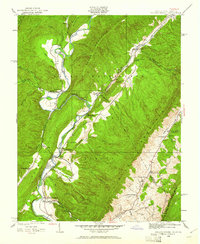
1929 Map of Falling Spring
USGS Topo · Published 1961About this map
The Jackson River carves a deep path through this borderland of the George Washington National Forest, where topography defines the limits of human settlement. Surveyed in the late 1920s, the map reveals a landscape where the Chesapeake and Ohio railroad follows the river's winding course through The Gorge, connecting isolated communities like Greavers Mill and Falling Spring. The narrow valleys between Coles Mountain and Warm Springs Mtn are dotted with the essential infrastructure of early 20th-century rural life, including the Morris Hill Sch and Natural Well Ch.
Find a feature on this map
49 named features on this map. Tap any name to fly to it.
Don’t see what you’re looking for? This feature index may not catch every label — zoom into the map to look around manually.
Map Details
Editions of this 1929 Falling Spring Map
2 editions found

Other maps of this area

1887 · Lewisburg
USGS Topo · 1:125,000

1891 · Lewisburg
USGS Topo · 1:125,000

1891 · Huntersville
USGS Topo · 1:125,000

1894 · Huntersville
USGS Topo · 1:125,000

1894 · Natural Bridge
USGS Topo · 1:125,000

1901 · Monterey
USGS Topo · 1:125,000

1921 · Callaghan
USGS Topo · 1:48,000

1923 · Marlinton
USGS Topo · 1:48,000

1923 · Warm Springs
USGS Topo · 1:48,000

1923 · Callaghan
USGS Topo · 1:62,500