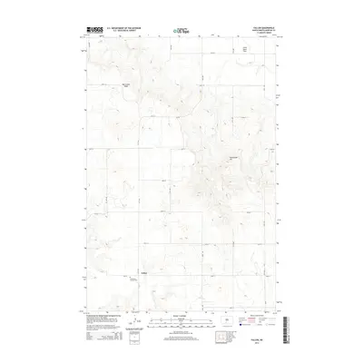
2014 Map of Fallon
USGS Topo · Published 2014About this map
Fallon sits within the rural expanses of Morton County, North Dakota, serving as a focal point for this agricultural region. The landscape is defined by the high ground of Oak Coulee Ridge to the northwest and the prominent Rattlesnake Hill to the east. These elevations overlook the Little Heart Flats, a name reflecting the local topography and drainage patterns. For genealogists and local historians, the Saint Peter and Paul Cem is a significant landmark, marking a place of community and heritage near the intersection of 62nd St and 31st Ave. The map also details the extensive local road network, including county routes such as CR-136 and CR-135, which connect the scattered homesteads across this prairie terrain.
Find a feature on this map
26 named features on this map. Tap any name to fly to it.
Don’t see what you’re looking for? This feature index may not catch every label — zoom into the map to look around manually.
Map Details
Editions of this 2014 Fallon Map
This is the sole edition of this map. No revisions or reprints were ever made.
Other maps of this area

1907 · Bismarck
USGS Topo · 1:125,000

1954 · Bismarck
USGS Topo · 1:250,000

1958 · Bismarck
USGS Topo · 1:250,000

1979 · Bismarck
USGS Topo · 1:100,000

1980 · Breien
USGS Topo · 1:24,000

1980 · Fallon NE
USGS Topo · 1:24,000

1980 · Burgess
USGS Topo · 1:24,000
1980 · Linton
USGS Topo · 1:100,000
1980 · Lynwood
USGS Topo · 1:24,000
1980 · Saint Anthony
USGS Topo · 1:24,000