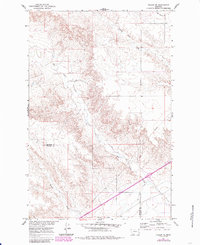
1967 Map of Fallon NE
USGS Topo · Published 1985About this map
The boundary between Dawson and Prairie Counties runs through this sparsely settled Montana landscape, where the Missouri River Basin development program shaped the local hydrology. The drainage of Bad Route Creek and Cracker Box Creek dominates the topography, illustrating the complex erosion patterns typical of the region. In the southern portion of the map, the introduction of the Main Canal signifies the shift toward managed water resources for agriculture, a stark contrast to the intermittent flows of Hatchet Creek. A modern Pipeline cuts across the eastern sections, marking the intersection of traditional ranching terrain with industrial infrastructure during the mid-20th century. The map captures a transition from purely natural drainage to a more engineered environment as the state's irrigation and energy networks expanded.
Find a feature on this map
7 named features on this map. Tap any name to fly to it.
Don’t see what you’re looking for? This feature index may not catch every label — zoom into the map to look around manually.
Map Details
Editions of this 1967 Fallon NE Map
2 editions found
Other maps of this area

1909 · Glendive
USGS Topo · 1:250,000

1953 · Miles City
USGS Topo · 1:250,000

1954 · Glendive
USGS Topo · 1:250,000

1957 · Miles City
USGS Topo · 1:250,000

1957 · Glendive
USGS Topo · 1:250,000

1958 · Miles City
USGS Topo · 1:250,000

1958 · Glendive
USGS Topo · 1:250,000

1966 · Fallon
USGS Topo · 1:24,000

1966 · Marsh SW
USGS Topo · 1:24,000

1967 · Marsh
USGS Topo · 1:24,000