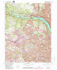
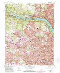
1965 Map of Falls Church
USGS Topo · Published 1984About this map
The Potomac River carves a dramatic boundary between Virginia and Maryland, defined here by the churning waters of Stubblefield Falls and Yellow Falls within the Mather Gorge. This mid-century landscape captures the intense post-war suburbanization of Northern Virginia, where residential developments like McLean Hamlet and Bannockburn began to fill the spaces between historic crossroads. Significant federal installations anchor the riverbanks, including the Central Intelligence Agency and the David Taylor Model Basin, while the inland topography is marked by prominent high points such as Minor Hill and Gantt Hill. Traces of earlier industry remain visible in the north near Great Falls National Park, where an Abandoned Gold Mine sits near the river. The transition of the regional transportation network is evident in the presence of the W & O D Railroad alongside newly burgeoning thoroughfares like the Capital Beltway.
Find a feature on this map
204 named features on this map. Tap any name to fly to it.
Don’t see what you’re looking for? This feature index may not catch every label — zoom into the map to look around manually.
Map Details
Editions of this 1965 Falls Church Map
5 editions found
Other maps of this area

1890 · Mt. Vernon
USGS Topo · 1:125,000

1891 · Mt. Vernon
USGS Topo · 1:125,000

1893 · Frederick
USGS Topo · 1:125,000

1894 · Frederick
USGS Topo · 1:125,000

1894 · Mt. Vernon
USGS Topo · 1:125,000

1897 · Mt. Vernon
USGS Topo · 1:125,000

1900 · Washington
USGS Topo · 1:62,500

1908 · Rockville
USGS Topo · 1:62,500

1908 · Seneca
USGS Topo · 1:62,500

1915 · Fairfax
USGS Topo · 1:62,500