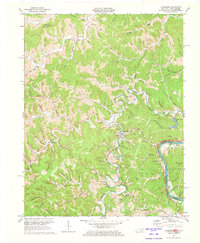
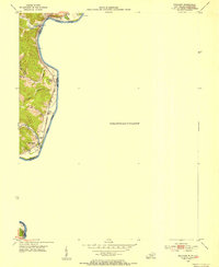
1971 Map of Fallsburg
USGS Topo · Published 1973About this map
The Big Sandy River and Blaine Creek define the geography of this Kentucky-West Virginia borderland, where steep hollows and narrow valleys dictated the layout of small 20th-century settlements. Fallsburg and Stringtown sit along the winding course of Blaine Creek, which features a notable Covered Bridge near Yatesville. The area's industrial character is marked by numerous Oil Well and Mines labels scattered throughout the drainages, alongside the heavy infrastructure of the Chesapeake and Ohio RR and the Norfolk and Western Railway following the riverbanks. For genealogists and local historians, the sheet is exceptionally dense with rural landmarks, including isolated churches like Garrett Chapel and Myrtle Chapel, and small school sites such as Green Valley Sch and Morgana Creek Sch. The map preserves the name of many family-associated landmarks, from Grubb Bend to the myriad small cemeteries that dot the hillsides above the creek forks.
Find a feature on this map
91 named features on this map. Tap any name to fly to it.
Don’t see what you’re looking for? This feature index may not catch every label — zoom into the map to look around manually.
Map Details
Editions of this 1971 Fallsburg Map
4 editions found
Other maps of this area

1901 · Ceredo
USGS Topo · 1:62,500

1903 · Kenova
USGS Topo · 1:125,000

1904 · Kenova
USGS Topo · 1:125,000

1911 · Louisa
USGS Topo · 1:48,000

1913 · Ceredo
USGS Topo · 1:62,500

1913 · Louisa
USGS Topo · 1:62,500

1939 · Louisa
USGS Topo · 1:62,500
1953 · Prichard
USGS Topo · 1:24,000

1953 · Rush
USGS Topo · 1:24,000

1953 · Boltsfork
USGS Topo · 1:24,000