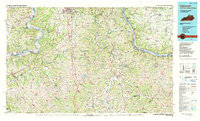
1986 Map of Falmouth
USGS Topo · Published 1990About this map
The Licking River and Ohio River dominate this mid-1980s landscape, where Northern Kentucky’s ridge-and-valley topography meets the industrial and agricultural heartland. The junction of the South Fork Licking River and Main Licking River at Falmouth serves as a focal point for the region's hydrography, while further west, the Kentucky River carves its way through Gallatin and Carroll counties near Warsaw. The map illustrates a mature transportation network, featuring the L & N Railroad and C & O Railroad corridors alongside major interstate arteries like I-75 and I-71. Local landmarks such as White Chapel and Mount Plagah Church provide essential reference points for genealogists, while conservation and recreation areas like Big Bone Lick State Park and Kincaid Lake State Park highlight the preservation of the area's natural history and Pleistocene fossil heritage.
Find a feature on this map
245 named features on this map. Tap any name to fly to it.
Don’t see what you’re looking for? This feature index may not catch every label — zoom into the map to look around manually.
Map Details
Editions of this 1986 Falmouth Map
2 editions found
Other maps of this area

1898 · East Cincinnati
USGS Topo · 1:62,500

1906 · Lockport
USGS Topo · 1:48,000

1908 · Lockport
USGS Topo · 1:62,500

1914 · East Cincinnati
USGS Topo · 1:62,500

1914 · West Cincinnati
USGS Topo · 1:62,500

1914 · Batavia
USGS Topo · 1:48,000

1915 · Lawrenceburg
USGS Topo · 1:48,000

1915 · Maysville
USGS Topo · 1:62,500

1916 · Batavia
USGS Topo · 1:62,500

1917 · Sardinia
USGS Topo · 1:62,500