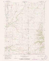
1959 Map of Falmouth
USGS Topo · Published 1988About this map
Raleigh and Falmouth anchor this landscape along the border of Rush and Fayette counties, illustrating the mid-century agricultural and infrastructure patterns of East Central Indiana. The drainage of the land is carefully detailed through an extensive network of human-made and natural waterways, including Glidden Ditch and the North Fork Blue River, which support the surrounding farmsteads. Cultural markers like the Township Sch and various rural sanctuaries such as Plum Creek Ch and Fairview Ch point to the community-centered layout of the era.
Find a feature on this map
33 named features on this map. Tap any name to fly to it.
Don’t see what you’re looking for? This feature index may not catch every label — zoom into the map to look around manually.
Map Details
Editions of this 1959 Falmouth Map
2 editions found

Other maps of this area

1948 · Lewisville
USGS Topo · 1:24,000

1950 · Dunreith
USGS Topo · 1:24,000

1950 · Lewisville
USGS Topo · 1:24,000

1953 · Cincinnati
USGS Topo · 1:250,000

1956 · Alpine
USGS Topo · 1:24,000

1956 · Connersville
USGS Topo · 1:24,000

1957 · Cincinnati
USGS Topo · 1:250,000

1959 · Rushville
USGS Topo · 1:24,000

1959 · New Salem
USGS Topo · 1:24,000

1959 · Mays
USGS Topo · 1:24,000