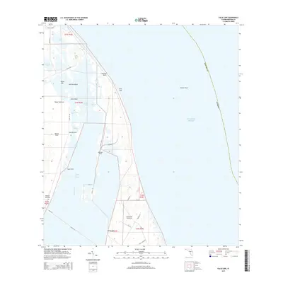
2015 Map of False Cape
USGS Topo · Published 2015About this map
Canaveral Peninsula and the eastern reaches of Merritt Island define this coastal landscape during a period of significant aerospace infrastructure. The map documents a complex network of specialized transportation routes, including the Crawlerway, Saturn Cswy, and Titan III Rd, which support operations across the barrier islands and marshes. These heavy-duty corridors cut through natural features like Pepper Flats and Hamper Hammock, illustrating the intersection of sensitive wetlands and high-technology facilities.
Find a feature on this map
45 named features on this map. Tap any name to fly to it.
Don’t see what you’re looking for? This feature index may not catch every label — zoom into the map to look around manually.
Map Details
Editions of this 2015 False Cape Map
This is the sole edition of this map. No revisions or reprints were ever made.
Other maps of this area

1949 · Orsino
USGS Topo · 1:24,000

1949 · False Cape
USGS Topo · 1:24,000

1949 · Courtenay
USGS Topo · 1:24,000

1949 · Wilson
USGS Topo · 1:24,000

1951 · False Cape
USGS Topo · 1:24,000

1951 · Courtenay
USGS Topo · 1:24,000

1951 · Orsino
USGS Topo · 1:24,000
1951 · Cape Canaveral
USGS Topo · 1:24,000

1952 · Wilson
USGS Topo · 1:24,000

1955 · Orlando
USGS Topo · 1:250,000