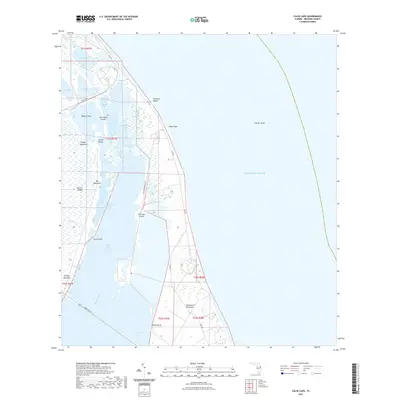
2021 Map of False Cape
USGS Topo · Published 2021About this map
The Canaveral Peninsula and Merritt Island dominate this coastal survey, where the unique infrastructure of the American space program intersects with a complex wetland ecosystem. The map reveals the specialized transport network serving the region, including the Crawlerway, US Government RR, and roads such as ICBM Rd and NASA Pkwy E. These man-made corridors cut through a landscape of tidal marshes and lagoons, bridging the gap between the mainland and the Atlantic Ocean.
Find a feature on this map
40 named features on this map. Tap any name to fly to it.
Don’t see what you’re looking for? This feature index may not catch every label — zoom into the map to look around manually.
Map Details
Editions of this 2021 False Cape Map
This is the sole edition of this map. No revisions or reprints were ever made.
Other maps of this area

1949 · Orsino
USGS Topo · 1:24,000

1949 · False Cape
USGS Topo · 1:24,000

1949 · Courtenay
USGS Topo · 1:24,000

1949 · Wilson
USGS Topo · 1:24,000

1951 · False Cape
USGS Topo · 1:24,000

1951 · Courtenay
USGS Topo · 1:24,000

1951 · Orsino
USGS Topo · 1:24,000
1951 · Cape Canaveral
USGS Topo · 1:24,000

1952 · Wilson
USGS Topo · 1:24,000

1955 · Orlando
USGS Topo · 1:250,000