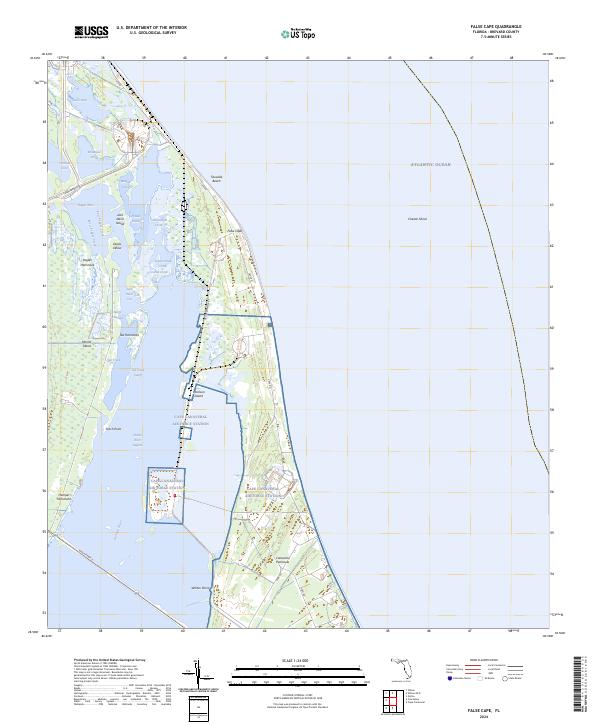
2024 Map of False Cape
USGS Topo · Published 2024About this map
Cape Canaveral Air Force Station and the Merritt Island National Wildlife Refuge dominate this coastal Florida landscape, where aerospace infrastructure meets protected wetlands. The map details the specialized transportation networks required for space flight, including the Crawlerway and the US Government RR, alongside specialized routes like ICBM Rd and NASA Pkwy E. This intersection of high-technology and nature is bounded by the Atlantic Ocean to the east and the Indian River Lagoon to the west. Between these waters lies the Canaveral Peninsula, dotted with hammock terrain and named features like Harrison Island and Jack Davis Island. Many small waterways, such as Broadaxe Creek and Bluebill Creek, wind through the refuge near False Cape, illustrating the complex hydrology of the barrier island system.
Find a feature on this map
44 named features on this map. Tap any name to fly to it.
Don’t see what you’re looking for? This feature index may not catch every label — zoom into the map to look around manually.
Map Details
Editions of this 2024 False Cape Map
This is the sole edition of this map. No revisions or reprints were ever made.
Other maps of this area

1949 · Orsino
USGS Topo · 1:24,000

1949 · False Cape
USGS Topo · 1:24,000

1949 · Courtenay
USGS Topo · 1:24,000

1949 · Wilson
USGS Topo · 1:24,000

1951 · False Cape
USGS Topo · 1:24,000

1951 · Courtenay
USGS Topo · 1:24,000

1951 · Orsino
USGS Topo · 1:24,000
1951 · Cape Canaveral
USGS Topo · 1:24,000

1952 · Wilson
USGS Topo · 1:24,000

1955 · Orlando
USGS Topo · 1:250,000