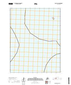
2020 Map of False Pass D-2 SW
USGS Topo · Published 2020About this map
Sozavarika Island sits as a solitary terrestrial feature amidst the expanse of the Pacific Ocean in this coastal Alaskan survey. Located within the Aleutians East region, the island is the primary navigational landmark in an area otherwise defined by open water and precise maritime boundaries. The map provides a look at the Public Land Survey System grids, specifically marking sections within t61s r88w, t62s r89w, and t62s r88w. This layout illustrates how modern cartography organizes remote maritime territories into manageable townships and ranges, even in the absence of traditional terrestrial roads or infrastructure.
Find a feature on this map
6 named features on this map. Tap any name to fly to it.
Don’t see what you’re looking for? This feature index may not catch every label — zoom into the map to look around manually.
Map Details
Editions of this 2020 False Pass D-2 SW Map
This is the sole edition of this map. No revisions or reprints were ever made.
Other maps of this area

1949 · False Pass
USGS Topo · 1:250,000

1950 · False Pass
USGS Topo · 1:250,000
1963 · False Pass D-3
USGS Topo · 1:63,360
1963 · False Pass C-2
USGS Topo · 1:63,360

1963 · False Pass D-2
USGS Topo · 1:63,360
2020 · False Pass C-2 NE
USGS Topo · 1:25,000
2020 · False Pass D-2 NE
USGS Topo · 1:25,000
2020 · False Pass D-3 NE
USGS Topo · 1:25,000
2020 · False Pass D-3 SE
USGS Topo · 1:25,000
2020 · False Pass D-2 NW
USGS Topo · 1:25,000