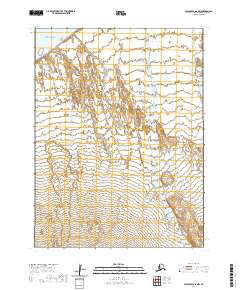
2020 Map of False Pass D-6 NW
USGS Topo · Published 2020About this map
Unimak Island serves as the focal point of this 2020 coastal survey, capturing the windswept and unpopulated northern reaches of the Aleutian archipelago. The map illustrates a landscape of complex topography and hydrological patterns where the Bering Sea meets the shore. The terrain is defined by low-lying wetlands and intricate drainages, including the course of Coal Oil Cr as it flows toward the sea.
Find a feature on this map
8 named features on this map. Tap any name to fly to it.
Don’t see what you’re looking for? This feature index may not catch every label — zoom into the map to look around manually.
Map Details
Editions of this 2020 False Pass D-6 NW Map
This is the sole edition of this map. No revisions or reprints were ever made.
Other maps of this area

1943 · Fort Randall
USGS Topo · 1:250,000

1949 · False Pass
USGS Topo · 1:250,000

1949 · Fort Randall
USGS Topo · 1:250,000

1950 · False Pass
USGS Topo · 1:250,000

1950 · Fort Randall
USGS Topo · 1:250,000

1951 · Unimak
USGS Topo · 1:250,000

1958 · Unimak
USGS Topo · 1:250,000
1989 · Unimak D-1
USGS Topo · 1:63,360
1989 · Cold Bay A-6
USGS Topo · 1:63,360
1989 · False Pass D-6
USGS Topo · 1:63,360