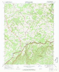
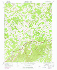
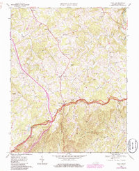
1968 Map of Fancy Gap
USGS Topo · Published 1971About this map
The Blue Ridge crest defines this Carroll County landscape, where the Blue Ridge Parkway winds along the high ridgeline, passing through the mountain pass at Fancy Gap. This late-1960s survey documents a rural Appalachian community organized around its ridge-top overlooks and deep valley drainages. Small settlements like Sunnyside and Red Hill are clustered near numerous country churches, including Sky View Ch and Mountain Plains Ch, while family history is etched into the terrain at Webb Cem and the Banks Cem. A lone Mine near Mine Branch and the Fancy Gap Sch point to the local industry and civic life of the era. The mapping of fence and field lines via aerial photography provides an exceptionally detailed view of land use, from the fairways at Skyland Lakes to the natural rocky features like Devils Den.
Find a feature on this map
46 named features on this map. Tap any name to fly to it.
Don’t see what you’re looking for? This feature index may not catch every label — zoom into the map to look around manually.
Map Details
Editions of this 1968 Fancy Gap Map
Other maps of this area

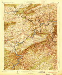
1889 · Hillsville
USGS Topo · 1:125,000

1892 · Hillsville
USGS Topo · 1:125,000

1896 · Hillsville
USGS Topo · 1:125,000
1930 · Max Meadows
USGS Topo · 1:62,500

1931 · Galax
USGS Topo · 1:48,000

1933 · Galax
USGS Topo · 1:62,500

1953 · Winston-Salem
USGS Topo · 1:250,000

1955 · Winston-Salem
USGS Topo · 1:250,000

1956 · Macks Mountain
USGS Topo · 1:62,500

1957 · Mount Airy
USGS Topo · 1:62,500