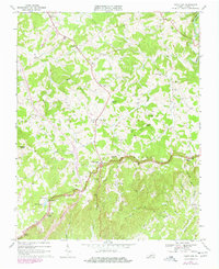
1968 Map of Fancy Gap
USGS Topo · Published 1978About this map
The Blue Ridge crest forms a dramatic spine through this 1960s survey, marking a landscape of high knobs and steep ravines where the plateau breaks toward the Piedmont. Central to the sheet is the settlement of Fancy Gap, a vital mountain pass where local life centered around the Fancy Gap Sch and Fancy Gap Ch. The cultural geography is defined by a high density of rural institutions, from Sky View Ch near the gap to the family-named Webb Cem and Morris Cem.
Find a feature on this map
44 named features on this map. Tap any name to fly to it.
Don’t see what you’re looking for? This feature index may not catch every label — zoom into the map to look around manually.
Map Details
Editions of this 1968 Fancy Gap Map
Other maps of this area

1889 · Hillsville
USGS Topo · 1:125,000

1892 · Hillsville
USGS Topo · 1:125,000

1896 · Hillsville
USGS Topo · 1:125,000

1930 · Max Meadows
USGS Topo · 1:62,500

1931 · Galax
USGS Topo · 1:48,000

1933 · Galax
USGS Topo · 1:62,500

1953 · Winston-Salem
USGS Topo · 1:250,000

1955 · Winston-Salem
USGS Topo · 1:250,000

1956 · Macks Mountain
USGS Topo · 1:62,500

1957 · Mount Airy
USGS Topo · 1:62,500