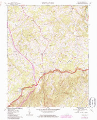
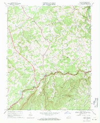
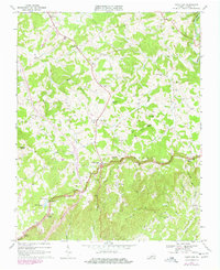
1968 Map of Fancy Gap
USGS Topo · Published 1986About this map
Blue Ridge topography dominates this 1968 survey of the Carroll County highlands, where the Blue Ridge Parkway winds along the primary escarpment. The settlement at Fancy Gap serves as a central hub, flanked by high peaks like Bobbitt Knob and Mitchell Knob. This area is characterized by a dense network of mountain churches and family cemeteries, reflecting a deeply rooted rural community. Many institutions, such as the Fancy Gap Sch and Mountain Plains Ch, are situated along the ridge-top roads, while the headwaters of Snake Creek and Waterfall Branch carve steep drainage patterns toward the valley floors. Interpretive details include the Skyland Lakes development and the nearby Golf Course, signaling the mid-century growth of recreational land use alongside traditional landmarks like the Water Tank and various mountain overlooks.
Find a feature on this map
42 named features on this map. Tap any name to fly to it.
Don’t see what you’re looking for? This feature index may not catch every label — zoom into the map to look around manually.
Map Details
Editions of this 1968 Fancy Gap Map
Other maps of this area

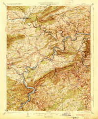
1889 · Hillsville
USGS Topo · 1:125,000

1892 · Hillsville
USGS Topo · 1:125,000

1896 · Hillsville
USGS Topo · 1:125,000
1930 · Max Meadows
USGS Topo · 1:62,500

1931 · Galax
USGS Topo · 1:48,000

1933 · Galax
USGS Topo · 1:62,500

1953 · Winston-Salem
USGS Topo · 1:250,000

1955 · Winston-Salem
USGS Topo · 1:250,000

1956 · Macks Mountain
USGS Topo · 1:62,500

1957 · Mount Airy
USGS Topo · 1:62,500