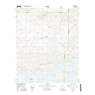
2014 Map of Fannie
USGS Topo · Published 2014About this map
The expansive waters of Lake Ouachita dominate the southern half of this landscape, where the inundated valleys of the Ouachita National Forest meet the foothills of Sandlick Mtn. Small settlements like Fannie and Liberty sit north of the lake along State Hwy 298, reflecting the rural character of Montgomery County before the terrain rises into the surrounding ridges. Local history is anchored by family-named sites such as Breashears Cem and Lee Cem, while the lake's edge at Little Fir Landing marks a primary point of access to the reservoir. The map reveals a complex network of forest roads and trails, including Horsewhip Trl and Whippoorwill Rd, which navigate the drainages of Irons Fork and Muddy Creek.
Find a feature on this map
38 named features on this map. Tap any name to fly to it.
Don’t see what you’re looking for? This feature index may not catch every label — zoom into the map to look around manually.
Map Details
Editions of this 2014 Fannie Map
This is the sole edition of this map. No revisions or reprints were ever made.
Other maps of this area

1890 · Mount Ida
USGS Topo · 1:125,000

1890 · Hot Springs
USGS Topo · 1:125,000

1894 · Hot Springs
USGS Topo · 1:125,000

1955 · Little Rock
USGS Topo · 1:250,000

1956 · Little Rock
USGS Topo · 1:250,000

1959 · Mount Ida
USGS Topo · 1:62,500

1960 · Little Rock
USGS Topo · 1:250,000

1960 · Gravelly
USGS Topo · 1:62,500

1962 · Crystal Springs
USGS Topo · 1:24,000

1962 · Avant
USGS Topo · 1:24,000