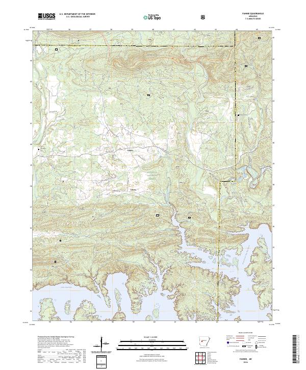
2024 Map of Fannie
USGS Topo · Published 2024About this map
Lake Ouachita dominates the southern reaches of this landscape, its intricate, branching shoreline defining the topography where the North Fork Ouachita River meets the reservoir. In the northern interior, the settlement of Fannie serves as a local crossroads near the base of Sandlick Mtn, while the community of Liberty sits further south along Union Hill Rd. The map reveals a high concentration of heritage sites for family researchers, including Breashears Cem and Oakwood Cem, tucked away from the main thoroughfares. Much of the terrain is managed as part of the Ouachita National Forest, intersected by the Ouachita National Recreation Trl. The northern boundary reflects a rural transition at the Yell Co Cem, where the mountains begin to give way to the headwaters of Irons Fork and Smith Creek.
Find a feature on this map
39 named features on this map. Tap any name to fly to it.
Don’t see what you’re looking for? This feature index may not catch every label — zoom into the map to look around manually.
Map Details
Editions of this 2024 Fannie Map
This is the sole edition of this map. No revisions or reprints were ever made.
Other maps of this area

1890 · Mount Ida
USGS Topo · 1:125,000

1890 · Hot Springs
USGS Topo · 1:125,000

1894 · Hot Springs
USGS Topo · 1:125,000

1955 · Little Rock
USGS Topo · 1:250,000

1956 · Little Rock
USGS Topo · 1:250,000

1959 · Mount Ida
USGS Topo · 1:62,500

1960 · Little Rock
USGS Topo · 1:250,000

1960 · Gravelly
USGS Topo · 1:62,500

1962 · Crystal Springs
USGS Topo · 1:24,000

1962 · Avant
USGS Topo · 1:24,000