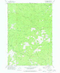
1974 Map of Fanno Ridge
USGS Topo · Published 1977About this map
Little Luckiamute River winds through this timber-rich portion of Polk County, where the managed landscapes of the Geo B Gerlinger State Experimental Forest dominate the northeastern corner. This mid-1970s survey reflects an era of intensive forest management and logging activity, centered around the settlement at Black Rock. The geography is defined by the water system of the Little Luckiamute River, which provided the primary drainage for the surrounding hills and supported the local timber industry. Researchers will find a landscape where industrial forestry and small settlements meet, preserved here before further modern developments or changes in forest management practices altered the local environment.
Find a feature on this map
3 named features on this map. Tap any name to fly to it.
Don’t see what you’re looking for? This feature index may not catch every label — zoom into the map to look around manually.
Map Details
Editions of this 1974 Fanno Ridge Map
This is the sole edition of this map. No revisions or reprints were ever made.
Other maps of this area

1921 · Corvallis
USGS Topo · 1:62,500

1939 · Marys Peak
USGS Topo · 1:62,500

1942 · Marys Peak
USGS Topo · 1:62,500

1942 · Corvallis
USGS Topo · 1:62,500

1942 · Valsetz
USGS Topo · 1:62,500

1942 · Dallas
USGS Topo · 1:62,500

1953 · Salem
USGS Topo · 1:250,000

1954 · Salem
USGS Topo · 1:250,000
1956 · Corvallis
USGS Topo · 1:62,500

1956 · Valsetz
USGS Topo · 1:62,500